Tide stations in the Netherlands

This is the list of all measuring stations for tides and water heights in the Netherlands, both at the sea, in the estuaries and large rivers and inland. Click on the name of the measuring station to request the current water level measurements, forecasts and graphs. You can sort the list by clicking on the word 'Station name' above the table.

Station name (click on the name)TypeLive water level NAPLive water level LATMore infoOn the map
A12 platformTides21 cm90 cmView measurements pageView this location on the water map
AadorpInland1000 cm-View measurements pageView this location on the water map
AalbudeInland cm-View measurements pageView this location on the water map
Aalst Opwaarts/DenderInland7.64 cm-View measurements pageView this location on the water map
Aalter/Kl Gent-OostendeInland5.77 cm-View measurements pageView this location on the water map
Aarschot Afwaarts/DemerInland10.51 cm-View measurements pageView this location on the water map
Aarschot Opwaarts/DemerInland12.41 cm-View measurements pageView this location on the water map
AchleitenInland cm-View measurements pageView this location on the water map
Achthöfener fleth sielInland cm-View measurements pageView this location on the water map
Adegem-Balgerhoeke Opwaarts/Afleidingskl LeieInland5.02 cm-View measurements pageView this location on the water map
Adinkerke/Kl Nieuwpoort-DuinkerkeInland2.56 cm-View measurements pageView this location on the water map
ADM NoordervaartInland3164 cm-View measurements pageView this location on the water map
AffoldernInland cm-View measurements pageView this location on the water map
AhldenInland cm-View measurements pageView this location on the water map
AkenInland cm-View measurements pageView this location on the water map
AlbertsheimInland cm-View measurements pageView this location on the water map
AllendorfInland cm-View measurements pageView this location on the water map
AlmenInland1003 cm-View measurements pageView this location on the water map
Alsleben opInland cm-View measurements pageView this location on the water map
Alsleben upInland cm-View measurements pageView this location on the water map
AltengammeInland cm-View measurements pageView this location on the water map
AlthagenInland cm-View measurements pageView this location on the water map
Amerongen benedenInland372 cm-View measurements pageView this location on the water map
Amerongen bovenInland583 cm-View measurements pageView this location on the water map
AndernachInland cm-View measurements pageView this location on the water map
AnklamInland cm-View measurements pageView this location on the water map
AntwerpenInland-121 cm-View measurements pageView this location on the water map
Antwerpen tij/ZeescheldeTides cm-View measurements pageView this location on the water map
Antwerps kanaalpandTides188 cm488 cmView measurements pageView this location on the water map
ArnhemInland840 cm-View measurements pageView this location on the water map
ArtlenburgInland cm-View measurements pageView this location on the water map
Asper Opwaarts/BovenscheldeInland8.39 cm-View measurements pageView this location on the water map
AstheimInland cm-View measurements pageView this location on the water map
AWG platformTides73 cm229 cmView measurements pageView this location on the water map
Awk strohbrückInland cm-View measurements pageView this location on the water map
BaalhoekTides-178 cm117 cmView measurements pageView this location on the water map
Bahnitz opInland cm-View measurements pageView this location on the water map
Bahnitz upInland cm-View measurements pageView this location on the water map
Bake aInland cm-View measurements pageView this location on the water map
Bake zInland cm-View measurements pageView this location on the water map
BambergInland cm-View measurements pageView this location on the water map
Banzkow opInland cm-View measurements pageView this location on the water map
BarbyInland cm-View measurements pageView this location on the water map
Bardowick opInland cm-View measurements pageView this location on the water map
Bardowick upInland cm-View measurements pageView this location on the water map
BarhöftInland cm-View measurements pageView this location on the water map
Barkow opInland cm-View measurements pageView this location on the water map
BarthInland cm-View measurements pageView this location on the water map
Basel-rheinhalleInland cm-View measurements pageView this location on the water map
BathTides128 cm427 cmView measurements pageView this location on the water map
Bathse brug DeltanutsTides2 cm213 cmView measurements pageView this location on the water map
Bathse spuikanaal InloopTides1 cm211 cmView measurements pageView this location on the water map
Bathse spuisluis kanaalTides-3 cm298 cmView measurements pageView this location on the water map
Bathse spuisluis WsTides-151 cm150 cmView measurements pageView this location on the water map
Belfeld benedenInland1164 cm-View measurements pageView this location on the water map
Belfeld bovenInland1420 cm-View measurements pageView this location on the water map
BelumInland cm-View measurements pageView this location on the water map
Benedensas SluisTides3 cm197 cmView measurements pageView this location on the water map
Bergenmeersen ggg 1 GOG/ZeescheldeInland3.03 cm-View measurements pageView this location on the water map
BergsediepsluisTides-120 cm84 cmView measurements pageView this location on the water map
Beringen/AlbertklInland29.66 cm-View measurements pageView this location on the water map
Berlin-charlottenburg opInland cm-View measurements pageView this location on the water map
Berlin-charlottenburg upInland cm-View measurements pageView this location on the water map
Berlin-köpenickInland cm-View measurements pageView this location on the water map
Berlin-mühlendamm opInland cm-View measurements pageView this location on the water map
Berlin-mühlendamm upInland cm-View measurements pageView this location on the water map
Berlin-oberschleuse opInland cm-View measurements pageView this location on the water map
Berlin-oberschleuse upInland cm-View measurements pageView this location on the water map
Berlin-plötzensee opInland cm-View measurements pageView this location on the water map
Berlin-plötzensee upInland cm-View measurements pageView this location on the water map
Berlin-schmöckwitzInland cm-View measurements pageView this location on the water map
Berlin-spandau opInland cm-View measurements pageView this location on the water map
Berlin-spandau upInland cm-View measurements pageView this location on the water map
Berlin-unterschleuse opInland cm-View measurements pageView this location on the water map
Berlin-unterschleuse upInland cm-View measurements pageView this location on the water map
Bernburg opInland cm-View measurements pageView this location on the water map
Bernburg upInland cm-View measurements pageView this location on the water map
Bernisse ZuidlandTides43 cm38 cmView measurements pageView this location on the water map
Besigheim skaInland cm-View measurements pageView this location on the water map
Betekom/DemerInland9.46 cm-View measurements pageView this location on the water map
Bhv alter leuchtturmInland cm-View measurements pageView this location on the water map
BingenInland cm-View measurements pageView this location on the water map
Bischofswerder opInland cm-View measurements pageView this location on the water map
Bischofswerder upInland cm-View measurements pageView this location on the water map
Blankenberge MVB tij/NoordzeeTides cm-View measurements pageView this location on the water map
Blankenese ufInland cm-View measurements pageView this location on the water map
BleckedeInland cm-View measurements pageView this location on the water map
Bobzin opInland cm-View measurements pageView this location on the water map
Bocholt Opwaarts/Zuid-WillemsvaartInland42.58 cm-View measurements pageView this location on the water map
BodenwerderInland cm-View measurements pageView this location on the water map
BoizenburgInland cm-View measurements pageView this location on the water map
Bommenede 1Inland-26 cm-View measurements pageView this location on the water map
BonaforthInland cm-View measurements pageView this location on the water map
BonnInland cm-View measurements pageView this location on the water map
Boom tij/RupelInland cm-View measurements pageView this location on the water map
BoppardInland cm-View measurements pageView this location on the water map
BorgfeldInland cm-View measurements pageView this location on the water map
Borgharen DorpInland3914 cm-View measurements pageView this location on the water map
Borgharen Julianakanaal 2Inland4393 cm-View measurements pageView this location on the water map
BorgsdorfInland cm-View measurements pageView this location on the water map
Borkum fischerbaljeInland cm-View measurements pageView this location on the water map
Borkum südstrandInland cm-View measurements pageView this location on the water map
BorsseleTides-194 cm69 cmView measurements pageView this location on the water map
Borssele AlphaTides-117 cm72 cmView measurements pageView this location on the water map
Bovenzanden ggg GOG/RupelInland cm-View measurements pageView this location on the water map
BrakeInland cm-View measurements pageView this location on the water map
Brandenburg opInland cm-View measurements pageView this location on the water map
Brandenburg upInland cm-View measurements pageView this location on the water map
BraubachInland cm-View measurements pageView this location on the water map
Brecht Sluis 2 Opwaarts/Kl Dessel-SchotenInland28.62 cm-View measurements pageView this location on the water map
Brecht Sluis 3 Opwaarts/Kl Dessel-SchotenInland26.1 cm-View measurements pageView this location on the water map
Breda TrambrugInland3 cm-View measurements pageView this location on the water map
Bredereiche opInland cm-View measurements pageView this location on the water map
Bredereiche upInland cm-View measurements pageView this location on the water map
BreisachInland cm-View measurements pageView this location on the water map
BreitenbergInland cm-View measurements pageView this location on the water map
Bremervörde uwInland cm-View measurements pageView this location on the water map
Breskens HandelshavenTides-174 cm78 cmView measurements pageView this location on the water map
BrokdorfInland cm-View measurements pageView this location on the water map
Brouwersdam 2 buiten ZuidTides-97 cm53 cmView measurements pageView this location on the water map
Brouwersdam 6 binnen ZuidTides-21 cm129 cmView measurements pageView this location on the water map
Brouwershavense Gat 2Tides-96 cm61 cmView measurements pageView this location on the water map
Brouwershavense Gat 8Tides-95 cm66 cmView measurements pageView this location on the water map
Brugge Afwaarts/ZuidervaartInland2.09 cm-View measurements pageView this location on the water map
Brugge Carmersbrug/Binnenarm Kl Gent-OostendeInland4.55 cm-View measurements pageView this location on the water map
Brugge Dampoortsluis Opwaarts/Kl Gent-OostendeInland5.69 cm-View measurements pageView this location on the water map
Brugge Opwaarts/ZuidervaartInland2.68 cm-View measurements pageView this location on the water map
Brugge-Steenbrugge/Kl Gent-OostendeInland5.73 cm-View measurements pageView this location on the water map
Brunsbüttel mpmInland cm-View measurements pageView this location on the water map
BuggenumInland1440 cm-View measurements pageView this location on the water map
BuitenhuizenInland-40 cm-View measurements pageView this location on the water map
BundeInland4402 cm-View measurements pageView this location on the water map
BunthausInland cm-View measurements pageView this location on the water map
Burchtse Weel GOG/ZeescheldeInland5.09 cm-View measurements pageView this location on the water map
BurgInland cm-View measurements pageView this location on the water map
Burgumerdaam BoezemInland-49 cm-View measurements pageView this location on the water map
BurowInland cm-View measurements pageView this location on the water map
ButtelerhörneInland cm-View measurements pageView this location on the water map
BuxtehudeInland cm-View measurements pageView this location on the water map
Büssau upInland cm-View measurements pageView this location on the water map
BüsumInland cm-View measurements pageView this location on the water map
CadzandTides-163 cm86 cmView measurements pageView this location on the water map
Calbe grizehneInland cm-View measurements pageView this location on the water map
Calbe opInland cm-View measurements pageView this location on the water map
Calbe upInland cm-View measurements pageView this location on the water map
CelleInland cm-View measurements pageView this location on the water map
CochemInland cm-View measurements pageView this location on the water map
CoswigInland cm-View measurements pageView this location on the water map
CranzInland cm-View measurements pageView this location on the water map
CrevecoeurInland76 cm-View measurements pageView this location on the water map
Culemborg brugInland303 cm-View measurements pageView this location on the water map
Cuxhaven steubenhöftInland cm-View measurements pageView this location on the water map
D15 platformTides63 cm187 cmView measurements pageView this location on the water map
DagebüllInland cm-View measurements pageView this location on the water map
DalumInland cm-View measurements pageView this location on the water map
DalwigksthalInland cm-View measurements pageView this location on the water map
Damme/Kl Brugge-SluisInland4.45 cm-View measurements pageView this location on the water map
Damme/LeopoldklInland1.71 cm-View measurements pageView this location on the water map
DamnatzInland cm-View measurements pageView this location on the water map
De SteegInland761 cm-View measurements pageView this location on the water map
DeggendorfInland cm-View measurements pageView this location on the water map
Deinze/Afleidingskl LeieInland5.82 cm-View measurements pageView this location on the water map
Deinze/LeieInland5.83 cm-View measurements pageView this location on the water map
Delden benedenInland1002 cm-View measurements pageView this location on the water map
Delden bovenInland1600 cm-View measurements pageView this location on the water map
DelfzijlTides39 cm256 cmView measurements pageView this location on the water map
DemminInland cm-View measurements pageView this location on the water map
Den HelderTides51 cm177 cmView measurements pageView this location on the water map
Den Helder Veersteiger 2Tides51 cm173 cmView measurements pageView this location on the water map
Den Oever binnenTides-18 cm93 cmView measurements pageView this location on the water map
Den Oever buitenTides74 cm185 cmView measurements pageView this location on the water map
Denderbelle Opwaarts/DenderInland5.99 cm-View measurements pageView this location on the water map
Denderleeuw Opwaarts/DenderInland10.35 cm-View measurements pageView this location on the water map
Dendermonde tij/ZeescheldeInland cm-View measurements pageView this location on the water map
Dendermonde/DenderInland4.38 cm-View measurements pageView this location on the water map
DessauInland cm-View measurements pageView this location on the water map
Dessel Sluis 4 Opwaarts/Kl Bocholt-HerentalsInland29.63 cm-View measurements pageView this location on the water map
Dessel Sluis 5 Opwaarts/Kl Bocholt-HerentalsInland27.82 cm-View measurements pageView this location on the water map
Dessel Witgoor/Kl Dessel-SchotenInland29.67 cm-View measurements pageView this location on the water map
Desselgem/LeieInland8.13 cm-View measurements pageView this location on the water map
Destelbergen/ZeescheldeInland3.51 cm-View measurements pageView this location on the water map
DetershagenInland cm-View measurements pageView this location on the water map
DeventerInland388 cm-View measurements pageView this location on the water map
DiemeltalsperreInland cm-View measurements pageView this location on the water map
Diepenbeek Opwaarts/AlbertklInland49.71 cm-View measurements pageView this location on the water map
Diez hafenInland cm-View measurements pageView this location on the water map
Diksmuide/IjzerInland3.21 cm-View measurements pageView this location on the water map
Dilsen-Stokkem/Zuid-WillemsvaartInland42.63 cm-View measurements pageView this location on the water map
DodewaardInland639 cm-View measurements pageView this location on the water map
Doesburg brugInland693 cm-View measurements pageView this location on the water map
Donnerschleuse opInland cm-View measurements pageView this location on the water map
DordrechtTides31 cm37 cmView measurements pageView this location on the water map
DorkwerdInland-84 cm-View measurements pageView this location on the water map
DrakenburgInland cm-View measurements pageView this location on the water map
DresdenInland cm-View measurements pageView this location on the water map
DreyeInland cm-View measurements pageView this location on the water map
DreyschlootInland cm-View measurements pageView this location on the water map
Driegoten tij/ZeescheldeInland cm-View measurements pageView this location on the water map
Driel benedenInland743 cm-View measurements pageView this location on the water map
Driel bovenInland751 cm-View measurements pageView this location on the water map
Duffel Sluis tij/NeteInland cm-View measurements pageView this location on the water map
Duisburg-ruhrortInland cm-View measurements pageView this location on the water map
DukegatInland cm-View measurements pageView this location on the water map
DwarsgatInland cm-View measurements pageView this location on the water map
DüsseldorfInland cm-View measurements pageView this location on the water map
DömitzInland cm-View measurements pageView this location on the water map
Dömitz opInland cm-View measurements pageView this location on the water map
Dömitz upInland cm-View measurements pageView this location on the water map
DörverdenInland cm-View measurements pageView this location on the water map
Eberswalde opInland cm-View measurements pageView this location on the water map
EchtInland3273 cm-View measurements pageView this location on the water map
EckernfördeInland cm-View measurements pageView this location on the water map
EdamInland-10 cm-View measurements pageView this location on the water map
EdertalsperreInland cm-View measurements pageView this location on the water map
Eefde benedenInland507 cm-View measurements pageView this location on the water map
Eefde bovenInland1006 cm-View measurements pageView this location on the water map
EemshavenTides56 cm251 cmView measurements pageView this location on the water map
EibersburenInland-53 cm-View measurements pageView this location on the water map
Eichhorst opInland cm-View measurements pageView this location on the water map
Eichhorst upInland cm-View measurements pageView this location on the water map
Eider-sperrwerk apInland cm-View measurements pageView this location on the water map
Eider-sperrwerk bpInland cm-View measurements pageView this location on the water map
Eijsden grensInland4477 cm-View measurements pageView this location on the water map
Eisden MazenhoveInland3050 cm-View measurements pageView this location on the water map
Eisden Mazenhove MGInland4030 cm-View measurements pageView this location on the water map
Eisden-Mazenhoven rkm 34.7/MaasInland cm-View measurements pageView this location on the water map
EisenhüttenstadtInland cm-View measurements pageView this location on the water map
Eisenhüttenstadt schl. opInland cm-View measurements pageView this location on the water map
Eisenhüttenstadt schl. upInland cm-View measurements pageView this location on the water map
Eiserne brückeInland cm-View measurements pageView this location on the water map
EitzeInland cm-View measurements pageView this location on the water map
ElburgerbrugInland-6 cm-View measurements pageView this location on the water map
Eldena opInland cm-View measurements pageView this location on the water map
Elmshorn hafenInland cm-View measurements pageView this location on the water map
ElsflethInland cm-View measurements pageView this location on the water map
Elsfleth ohrtInland cm-View measurements pageView this location on the water map
ElslooInland3423 cm-View measurements pageView this location on the water map
ElsterInland cm-View measurements pageView this location on the water map
Emblem tij/Kleine NeteInland cm-View measurements pageView this location on the water map
Emden neue seeschleuseInland cm-View measurements pageView this location on the water map
EmmerichInland cm-View measurements pageView this location on the water map
Empel benedenInland70 cm-View measurements pageView this location on the water map
Empel bovenInland197 cm-View measurements pageView this location on the water map
Empel sluisInland72 cm-View measurements pageView this location on the water map
EmshörnInland cm-View measurements pageView this location on the water map
EngelenInland220 cm-View measurements pageView this location on the water map
Eppegem/ZenneInland7.48 cm-View measurements pageView this location on the water map
Erembodegem/DenderInland7.65 cm-View measurements pageView this location on the water map
ErlauInland cm-View measurements pageView this location on the water map
Este inneres sperrwerk apInland cm-View measurements pageView this location on the water map
Este inneres sperrwerk bpInland cm-View measurements pageView this location on the water map
EuroplatformTides24 cm149 cmView measurements pageView this location on the water map
Evergem Opwaarts/RingvaartInland5.66 cm-View measurements pageView this location on the water map
Evergem/RingvaartInland4.55 cm-View measurements pageView this location on the water map
F3 platformTides28 cm81 cmView measurements pageView this location on the water map
Fahrenholz opInland cm-View measurements pageView this location on the water map
Fahrenholz upInland cm-View measurements pageView this location on the water map
FargeInland cm-View measurements pageView this location on the water map
FaulbachInland cm-View measurements pageView this location on the water map
Findenwirunshier opInland cm-View measurements pageView this location on the water map
FlensburgInland cm-View measurements pageView this location on the water map
Frankfurt osthafenInland cm-View measurements pageView this location on the water map
Frankfurt1 (oder)Inland cm-View measurements pageView this location on the water map
FremersdorfInland cm-View measurements pageView this location on the water map
Friedrichstadt strassenbrückeInland cm-View measurements pageView this location on the water map
Friedrichstadt treeneInland cm-View measurements pageView this location on the water map
FriedrichsthalInland cm-View measurements pageView this location on the water map
FuestrupInland cm-View measurements pageView this location on the water map
Fürstenberg opInland cm-View measurements pageView this location on the water map
Fürstenberg upInland cm-View measurements pageView this location on the water map
Fürstenwalde opInland cm-View measurements pageView this location on the water map
Fürstenwalde upInland cm-View measurements pageView this location on the water map
Gaarkeuken OostInland-95 cm-View measurements pageView this location on the water map
Gaarkeuken WestInland-54 cm-View measurements pageView this location on the water map
GalgenkampsbrugInland-18 cm-View measurements pageView this location on the water map
GartzInland cm-View measurements pageView this location on the water map
Garwitz upInland cm-View measurements pageView this location on the water map
Garz opInland cm-View measurements pageView this location on the water map
Garz upInland cm-View measurements pageView this location on the water map
Gavere/BovenscheldeInland5.84 cm-View measurements pageView this location on the water map
Geel Sluis 7 Opwaarts/Kl Bocholt-HerentalsInland23.72 cm-View measurements pageView this location on the water map
Geel Sluis 8 Opwaarts/Kl Bocholt-HerentalsInland21.22 cm-View measurements pageView this location on the water map
Geel Sluis 9 Opwaarts/Kl Bocholt-HerentalsInland19.24 cm-View measurements pageView this location on the water map
Geel-Zammel/Grote NeteInland13.97 cm-View measurements pageView this location on the water map
GeesthachtInland cm-View measurements pageView this location on the water map
Gellik/AlbertklInland60.02 cm-View measurements pageView this location on the water map
GenemuidenInland-16 cm-View measurements pageView this location on the water map
Genk Opwaarts/AlbertklInland60.07 cm-View measurements pageView this location on the water map
GennepInland797 cm-View measurements pageView this location on the water map
Gentbrugge tij/ZeescheldeInland cm-View measurements pageView this location on the water map
GenthinInland cm-View measurements pageView this location on the water map
Geraardsbergen Opwaarts/DenderInland16.82 cm-View measurements pageView this location on the water map
Geulhaven Radarpost 10Tides-36 cm42 cmView measurements pageView this location on the water map
Giessen klärwerkInland cm-View measurements pageView this location on the water map
GlückstadtInland cm-View measurements pageView this location on the water map
Gnevsdorf epInland cm-View measurements pageView this location on the water map
Gnevsdorf opInland cm-View measurements pageView this location on the water map
GoidschalxoordTides-3 cm31 cmView measurements pageView this location on the water map
GorlebenInland cm-View measurements pageView this location on the water map
Gouda brugTides4 cm44 cmView measurements pageView this location on the water map
Grabow opInland cm-View measurements pageView this location on the water map
Grafenbrück opInland cm-View measurements pageView this location on the water map
Grauerort reedeInland cm-View measurements pageView this location on the water map
Grave benedenInland508 cm-View measurements pageView this location on the water map
Grave bovenInland783 cm-View measurements pageView this location on the water map
GrebbeInland626 cm-View measurements pageView this location on the water map
GrebenauInland cm-View measurements pageView this location on the water map
Greifswald oieInland cm-View measurements pageView this location on the water map
Greifswald-wieckInland cm-View measurements pageView this location on the water map
Grobbendonk Opwaarts Krooshekken/Kleine NeteInland5.75 cm-View measurements pageView this location on the water map
Grobbendonk Troon/Kleine NeteInland6.44 cm-View measurements pageView this location on the water map
Grobbendonk/AlbertklInland9.76 cm-View measurements pageView this location on the water map
Groene Riv Pannerden benInland1143 cm-View measurements pageView this location on the water map
Groene Riv Pannerden bovInland1138 cm-View measurements pageView this location on the water map
Gross rosenburgInland cm-View measurements pageView this location on the water map
Grosse tränke wehr opInland cm-View measurements pageView this location on the water map
Grosse tränke wehr upInland cm-View measurements pageView this location on the water map
Grosse weserbrückeInland cm-View measurements pageView this location on the water map
Grote Vijver Noord GOG/NeteInland2.79 cm-View measurements pageView this location on the water map
Grütz opInland cm-View measurements pageView this location on the water map
Grütz upInland cm-View measurements pageView this location on the water map
GrönhudeInland cm-View measurements pageView this location on the water map
Gundelsheim upInland cm-View measurements pageView this location on the water map
GuntershausenInland cm-View measurements pageView this location on the water map
Gw-pwdrfp 01Inland cm-View measurements pageView this location on the water map
Gw-pwdrfp 02Inland cm-View measurements pageView this location on the water map
Gw-pwdrfp 03Inland cm-View measurements pageView this location on the water map
Gw-pwdrfp 04Inland cm-View measurements pageView this location on the water map
Gw-pwdrfp 05Inland cm-View measurements pageView this location on the water map
Gw-pwdrfp 06Inland cm-View measurements pageView this location on the water map
Gw-pwdrfp 07Inland cm-View measurements pageView this location on the water map
Gw-pwdrfp 08Inland cm-View measurements pageView this location on the water map
Gw-pwdrfp 09Inland cm-View measurements pageView this location on the water map
Gülpe opInland cm-View measurements pageView this location on the water map
Güritz opInland cm-View measurements pageView this location on the water map
Haandrik KruisbrugInland915 cm-View measurements pageView this location on the water map
Hagestein benedenInland156 cm-View measurements pageView this location on the water map
Hagestein bovenInland291 cm-View measurements pageView this location on the water map
Halle Opwaarts/Kl Brussel-CharleroiInland33.28 cm-View measurements pageView this location on the water map
Ham Sluis Vijzelkanaal/AlbertklInland29.52 cm-View measurements pageView this location on the water map
Hamburg st. pauliInland cm-View measurements pageView this location on the water map
Hamburg-harburgInland cm-View measurements pageView this location on the water map
Hameln wehrbergenInland cm-View measurements pageView this location on the water map
Hamme tij/DurmeInland cm-View measurements pageView this location on the water map
Hann.muendenInland cm-View measurements pageView this location on the water map
HansweertTides-189 cm93 cmView measurements pageView this location on the water map
Hansweert wind (b)Tides-188 cm94 cmView measurements pageView this location on the water map
Harelbeke 650m Opwaarts/LeieInland10.12 cm-View measurements pageView this location on the water map
Haringe/IjzerInland3.44 cm-View measurements pageView this location on the water map
Haringvliet 10 (f)Tides-57 cm-View measurements pageView this location on the water map
HarlingenTides85 cm225 cmView measurements pageView this location on the water map
HasehubbrückeInland cm-View measurements pageView this location on the water map
Hasselt Opwaarts/AlbertklInland39.69 cm-View measurements pageView this location on the water map
Hasselt Sluis Vijzelkanaal/AlbertklInland39.55 cm-View measurements pageView this location on the water map
Havelberg epInland cm-View measurements pageView this location on the water map
Havelberg stadtInland cm-View measurements pageView this location on the water map
Havelberg upInland cm-View measurements pageView this location on the water map
HechthausenInland cm-View measurements pageView this location on the water map
Heel benedenInland1441 cm-View measurements pageView this location on the water map
Heel bovenInland2084 cm-View measurements pageView this location on the water map
HeesbeenInland67 cm-View measurements pageView this location on the water map
Heidelberg upInland cm-View measurements pageView this location on the water map
HeiligenhafenInland cm-View measurements pageView this location on the water map
HeldraInland cm-View measurements pageView this location on the water map
Helgoland binnenhafenInland cm-View measurements pageView this location on the water map
Helgoland südhafenInland cm-View measurements pageView this location on the water map
Helkijn/BovenscheldeInland11.57 cm-View measurements pageView this location on the water map
HellevoetsluisTides51 cm51 cmView measurements pageView this location on the water map
HelminghausenInland cm-View measurements pageView this location on the water map
Helmond RWZI - bovenInland1502 cm-View measurements pageView this location on the water map
Hemiksem tij/ZeescheldeInland cm-View measurements pageView this location on the water map
Hengelo benedenInland1603 cm-View measurements pageView this location on the water map
Hengelo bovenInland2500 cm-View measurements pageView this location on the water map
Hengelo KoppelleidingInland1741 cm-View measurements pageView this location on the water map
Herbrum hafendammInland cm-View measurements pageView this location on the water map
Herbrum oberwasserInland cm-View measurements pageView this location on the water map
HerenlaakInland2120 cm-View measurements pageView this location on the water map
Herentals Sluis 10 Opwaarts/Kl Bocholt-HerentalsInland17.34 cm-View measurements pageView this location on the water map
HerrenhausenInland cm-View measurements pageView this location on the water map
HerzhausenInland cm-View measurements pageView this location on the water map
Hessigheim schleuse upInland cm-View measurements pageView this location on the water map
HetlingenInland cm-View measurements pageView this location on the water map
Himmelpfort opInland cm-View measurements pageView this location on the water map
Himmelpfort upInland cm-View measurements pageView this location on the water map
Hintham benedenInland199 cm-View measurements pageView this location on the water map
Hintham bovenInland477 cm-View measurements pageView this location on the water map
HitzackerInland cm-View measurements pageView this location on the water map
Hoek van HollandTides-49 cm43 cmView measurements pageView this location on the water map
HofkirchenInland cm-View measurements pageView this location on the water map
Hohensaaten ost apInland cm-View measurements pageView this location on the water map
Hohensaaten west apInland cm-View measurements pageView this location on the water map
Hohensaaten west bpInland cm-View measurements pageView this location on the water map
Hohensaaten-finowInland cm-View measurements pageView this location on the water map
HohnstorfInland cm-View measurements pageView this location on the water map
Hollandse brugInland-17 cm-View measurements pageView this location on the water map
HollersielInland cm-View measurements pageView this location on the water map
HolwerdTides121 cm291 cmView measurements pageView this location on the water map
Hombeek tij/ZenneInland cm-View measurements pageView this location on the water map
Hondsbroekse Pleij hwgeulInland1039 cm-View measurements pageView this location on the water map
Hondsbroekse Pleij IJsselInland879 cm-View measurements pageView this location on the water map
HooksielplateInland cm-View measurements pageView this location on the water map
HorneburgInland cm-View measurements pageView this location on the water map
Houtem Afwaarts/BergenvaartInland1.67 cm-View measurements pageView this location on the water map
Houtem Opwaarts/BergenvaartInland2.16 cm-View measurements pageView this location on the water map
Houtrib NoordInland-14 cm-View measurements pageView this location on the water map
Houtrib ZuidInland-18 cm-View measurements pageView this location on the water map
HoyaInland cm-View measurements pageView this location on the water map
HuibertgatTides86 cm253 cmView measurements pageView this location on the water map
Hulshout/Grote NeteInland7.55 cm-View measurements pageView this location on the water map
HundsmühlenInland cm-View measurements pageView this location on the water map
HuntebrückInland cm-View measurements pageView this location on the water map
HusumInland cm-View measurements pageView this location on the water map
HörnumInland cm-View measurements pageView this location on the water map
HöxterInland cm-View measurements pageView this location on the water map
Idegem Opwaarts/DenderInland15.28 cm-View measurements pageView this location on the water map
IffezheimInland cm-View measurements pageView this location on the water map
IJgeul stroommeetpaalTides-9 cm95 cmView measurements pageView this location on the water map
IJmuiden BuitenhavenTides-10 cm91 cmView measurements pageView this location on the water map
IJmuiden Noordersluis OTides-40 cm62 cmView measurements pageView this location on the water map
IJmuiden Noordersluis WTides-7 cm95 cmView measurements pageView this location on the water map
IJsselkopInland888 cm-View measurements pageView this location on the water map
IlmenauInland cm-View measurements pageView this location on the water map
Ilmenau sperrwerk apInland cm-View measurements pageView this location on the water map
IntschedeInland cm-View measurements pageView this location on the water map
Itegem Hullebrug/Grote NeteInland4.7 cm-View measurements pageView this location on the water map
Itzehoe hafenInland cm-View measurements pageView this location on the water map
Izegem/Kl Roeselare-LeieInland15.54 cm-View measurements pageView this location on the water map
J6 platformTides64 cm207 cmView measurements pageView this location on the water map
JarmenInland cm-View measurements pageView this location on the water map
K13 AlphaTides54 cm173 cmView measurements pageView this location on the water map
K14 platformTides62 cm181 cmView measurements pageView this location on the water map
Kachlet upInland cm-View measurements pageView this location on the water map
KadeInland cm-View measurements pageView this location on the water map
KadoelenInland-21 cm-View measurements pageView this location on the water map
Kalkofen neuInland cm-View measurements pageView this location on the water map
KalloInland-147 cm-View measurements pageView this location on the water map
Kallosluis tij/ZeescheldeInland cm-View measurements pageView this location on the water map
KampenInland-5 cm-View measurements pageView this location on the water map
KamperhoekInland-16 cm-View measurements pageView this location on the water map
KanalbrückeInland cm-View measurements pageView this location on the water map
Kanne (ADCP)/AlbertklInland cm-View measurements pageView this location on the water map
Kanne Opwaarts Duiker Afwaarts rooster/JekerInland58.53 cm-View measurements pageView this location on the water map
Kanne Opwaarts Duiker Opwaarts rooster/JekerInland58.6 cm-View measurements pageView this location on the water map
Kanne Opwaarts/JekerInland cm-View measurements pageView this location on the water map
Kanne Structuur/JekerInland58.22 cm-View measurements pageView this location on the water map
Kanne/AlbertklInland60.02 cm-View measurements pageView this location on the water map
KappelnInland cm-View measurements pageView this location on the water map
KarlshafenInland cm-View measurements pageView this location on the water map
KarlshagenInland cm-View measurements pageView this location on the water map
KarninInland cm-View measurements pageView this location on the water map
KaterveerInland96 cm-View measurements pageView this location on the water map
Kats ZandkreeksluisTides-114 cm68 cmView measurements pageView this location on the water map
Katsberg benedenInland3142 cm-View measurements pageView this location on the water map
Katsberg bovenInland3160 cm-View measurements pageView this location on the water map
KaubInland cm-View measurements pageView this location on the water map
Kehl-kronenhofInland cm-View measurements pageView this location on the water map
Keiem/IjzerInland3.2 cm-View measurements pageView this location on the water map
KeizersveerTides60 cm60 cmView measurements pageView this location on the water map
KelheimwinzerInland cm-View measurements pageView this location on the water map
Kerkhove Opwaarts/BovenscheldeInland11.49 cm-View measurements pageView this location on the water map
Kersdorf opInland cm-View measurements pageView this location on the water map
Kersdorf upInland cm-View measurements pageView this location on the water map
Kessel tij/Grote NeteInland cm-View measurements pageView this location on the water map
KeteldiepInland-15 cm-View measurements pageView this location on the water map
KetelhavenInland-19 cm-View measurements pageView this location on the water map
KetzinInland cm-View measurements pageView this location on the water map
Kiel-holtenauInland cm-View measurements pageView this location on the water map
KienitzInland cm-View measurements pageView this location on the water map
KietzInland cm-View measurements pageView this location on the water map
Klein laasch wehr opInland cm-View measurements pageView this location on the water map
KleinheubachInland cm-View measurements pageView this location on the water map
Kleinmachnow opInland cm-View measurements pageView this location on the water map
Kleinmachnow upInland cm-View measurements pageView this location on the water map
KlosterInland cm-View measurements pageView this location on the water map
KnockInland cm-View measurements pageView this location on the water map
KoblenzInland cm-View measurements pageView this location on the water map
Koblenz upInland cm-View measurements pageView this location on the water map
Koblenz-lützel dfhInland cm-View measurements pageView this location on the water map
KollmarInland cm-View measurements pageView this location on the water map
KonstanzInland cm-View measurements pageView this location on the water map
Kornwerderzand binnenTides-16 cm109 cmView measurements pageView this location on the water map
Kornwerderzand buitenTides84 cm209 cmView measurements pageView this location on the water map
Kortrijk Spinnerijkaai/Kl Bossuit-KortrijkInland14.9 cm-View measurements pageView this location on the water map
Kortrijk Vlaanderenkaai/Kl Bossuit-KortrijkInland12.98 cm-View measurements pageView this location on the water map
Kortrijk/LeieInland10.15 cm-View measurements pageView this location on the water map
KoserowInland cm-View measurements pageView this location on the water map
KotthausenInland cm-View measurements pageView this location on the water map
Krabbersgat NoordInland-12 cm-View measurements pageView this location on the water map
Krabbersgat ZuidInland-16 cm-View measurements pageView this location on the water map
Krammersluizen WestTides-120 cm73 cmView measurements pageView this location on the water map
Krautsand reedeInland cm-View measurements pageView this location on the water map
Krimpen a/d IJsselTides-1 cm42 cmView measurements pageView this location on the water map
Krimpen a/d LekTides16 cm56 cmView measurements pageView this location on the water map
KrotzenburgInland cm-View measurements pageView this location on the water map
Kruibeke GOG Kapelbeek/Ringgracht KBRInland1.09 cm-View measurements pageView this location on the water map
Kruibeke GOG-GGG Grote Uitlaat/ZeescheldeInland1.49 cm-View measurements pageView this location on the water map
Kruibeke-Bazel GOG Grote Uitwatering/ZeescheldeInland1.56 cm-View measurements pageView this location on the water map
Kruibeke-Bazel GOG Kleine Uitwatering/ZeescheldeInland0.39 cm-View measurements pageView this location on the water map
Kruibeke-Bazel GOG Langegaanw/Ringgr KBRInland1.08 cm-View measurements pageView this location on the water map
Krückau-sperrwerk apInland cm-View measurements pageView this location on the water map
Krückau-sperrwerk bpInland cm-View measurements pageView this location on the water map
Kummersdorf opInland cm-View measurements pageView this location on the water map
Kummersdorf upInland cm-View measurements pageView this location on the water map
Kwaadmechelen Opwaarts/AlbertklInland29.6 cm-View measurements pageView this location on the water map
KölnInland cm-View measurements pageView this location on the water map
L9 platformTides7 cm139 cmView measurements pageView this location on the water map
Lahnstein schleuse upInland cm-View measurements pageView this location on the water map
LanakenInland3814 cm-View measurements pageView this location on the water map
Lanaken Opwaarts/Kl Briegden-NeerharenInland60.09 cm-View measurements pageView this location on the water map
Lanaken-Smeermaas rkm 18.4/MaasInland40.44 cm-View measurements pageView this location on the water map
LangballigauInland cm-View measurements pageView this location on the water map
Langdorp/DemerInland12.61 cm-View measurements pageView this location on the water map
LangeoogInland cm-View measurements pageView this location on the water map
LauffenInland cm-View measurements pageView this location on the water map
LauterbachInland cm-View measurements pageView this location on the water map
Lauwe/LeieInland10.17 cm-View measurements pageView this location on the water map
LauwersoogTides74 cm244 cmView measurements pageView this location on the water map
Ledasperrwerk upInland cm-View measurements pageView this location on the water map
LeerortInland cm-View measurements pageView this location on the water map
Leesenbrück opInland cm-View measurements pageView this location on the water map
Lehnitz opInland cm-View measurements pageView this location on the water map
Lehnitz upInland cm-View measurements pageView this location on the water map
Lembeek/Kl Brussel-CharleroiInland40.39 cm-View measurements pageView this location on the water map
LemmerInland-19 cm-View measurements pageView this location on the water map
Lemmer BoezemInland-48 cm-View measurements pageView this location on the water map
Lemmer IJsselmeerInland-23 cm-View measurements pageView this location on the water map
LenzenInland cm-View measurements pageView this location on the water map
Letzter hellerInland cm-View measurements pageView this location on the water map
Leuchtturm alte weserInland cm-View measurements pageView this location on the water map
Leun neuInland cm-View measurements pageView this location on the water map
Lewitz opInland cm-View measurements pageView this location on the water map
Lexfähre oberwasserInland cm-View measurements pageView this location on the water map
Lexfähre unterwasserInland cm-View measurements pageView this location on the water map
Lichteiland GoereeTides-72 cm56 cmView measurements pageView this location on the water map
LiebenauInland cm-View measurements pageView this location on the water map
Liebenwalde opInland cm-View measurements pageView this location on the water map
Liebenwalde upInland cm-View measurements pageView this location on the water map
Liefkenshoek tij/ZeescheldeTides cm-View measurements pageView this location on the water map
Liepe opInland cm-View measurements pageView this location on the water map
Liepe upInland cm-View measurements pageView this location on the water map
Lier Maasfort tij/Grote NeteInland cm-View measurements pageView this location on the water map
Lier Molbrug tij/NeteInland cm-View measurements pageView this location on the water map
Limburg schleuse upInland cm-View measurements pageView this location on the water map
Lingen-darmeInland cm-View measurements pageView this location on the water map
Linne benedenInland1717 cm-View measurements pageView this location on the water map
Lippenbroek GOG/ZeescheldeInland3.4 cm-View measurements pageView this location on the water map
List auf syltInland cm-View measurements pageView this location on the water map
Lith bovenInland491 cm-View measurements pageView this location on the water map
Lith DorpInland80 cm-View measurements pageView this location on the water map
Lo-Fintele/IjzerInland3.24 cm-View measurements pageView this location on the water map
Lo-Fintele/LoklInland2.62 cm-View measurements pageView this location on the water map
Lo-Reninge/LoklInland2.62 cm-View measurements pageView this location on the water map
LobithInland1007 cm-View measurements pageView this location on the water map
Lobith HavenInland992 cm-View measurements pageView this location on the water map
Lommel Sluis 1 Opwaarts/Kl Bocholt-HerentalsInland42.59 cm-View measurements pageView this location on the water map
Lommel/Kl Bocholt-HerentalsInland42.63 cm-View measurements pageView this location on the water map
Looveer HuissenInland903 cm-View measurements pageView this location on the water map
LoozenInland3570 cm-View measurements pageView this location on the water map
Lot Opwaarts/Kl Brussel-CharleroiInland29.75 cm-View measurements pageView this location on the water map
Lozen Afwaarts/Zuid-WillemsvaartInland38.08 cm-View measurements pageView this location on the water map
Lozen Opwaarts/Zuid-WillemsvaartInland40.86 cm-View measurements pageView this location on the water map
Lt kalkgrundInland cm-View measurements pageView this location on the water map
Lt kielInland cm-View measurements pageView this location on the water map
Lübeck-bauhofInland cm-View measurements pageView this location on the water map
Lübz opInland cm-View measurements pageView this location on the water map
LühortInland cm-View measurements pageView this location on the water map
LüneInland cm-View measurements pageView this location on the water map
MaarssenInland-38 cm-View measurements pageView this location on the water map
Maasbeemder Greend/MaasplassenInland cm-View measurements pageView this location on the water map
MaaseikInland2199 cm-View measurements pageView this location on the water map
Maaseik Herenlaak/MaasplassenInland23.61 cm-View measurements pageView this location on the water map
Maaseik rkm 52.8/MaasInland24.33 cm-View measurements pageView this location on the water map
MaassluisTides-42 cm41 cmView measurements pageView this location on the water map
Machelen/LeieInland5.82 cm-View measurements pageView this location on the water map
Maeslantkering zeezijde NTides-45 cm46 cmView measurements pageView this location on the water map
Maeslantkering zeezijde ZTides-46 cm48 cmView measurements pageView this location on the water map
Magdeburg-buckauInland cm-View measurements pageView this location on the water map
Magdeburg-ro nwsInland cm-View measurements pageView this location on the water map
Magdeburg-strombrückeInland cm-View measurements pageView this location on the water map
MainflingenInland cm-View measurements pageView this location on the water map
MainzInland cm-View measurements pageView this location on the water map
Malchow wehr opInland cm-View measurements pageView this location on the water map
Malliss opInland cm-View measurements pageView this location on the water map
MannheimInland cm-View measurements pageView this location on the water map
Mannheim neckarInland cm-View measurements pageView this location on the water map
Marbach wehr upInland cm-View measurements pageView this location on the water map
MarienleuchteInland cm-View measurements pageView this location on the water map
Marienthal opInland cm-View measurements pageView this location on the water map
Marienthal upInland cm-View measurements pageView this location on the water map
Markelose brugInland1001 cm-View measurements pageView this location on the water map
MarklendorfInland cm-View measurements pageView this location on the water map
Marksluis beneden - MarkTides0 cm0 cmView measurements pageView this location on the water map
Marksluis boven - WHKTides59 cm59 cmView measurements pageView this location on the water map
MaxauInland cm-View measurements pageView this location on the water map
Mechelen Benedensluis tij/DijleInland cm-View measurements pageView this location on the water map
Mechelen Stuw Afwaarts tij/DijleInland cm-View measurements pageView this location on the water map
Mechelen Stuw Opwaarts tij/DijleInland cm-View measurements pageView this location on the water map
Meeswijk veerInland2842 cm-View measurements pageView this location on the water map
Meeswijk Veer rkm 39.0/MaasInland30.63 cm-View measurements pageView this location on the water map
MegenInland496 cm-View measurements pageView this location on the water map
MeissenInland cm-View measurements pageView this location on the water map
Melle tij/ZeescheldeInland cm-View measurements pageView this location on the water map
Melle/VuntebeekInland4.05 cm-View measurements pageView this location on the water map
MellumplateInland cm-View measurements pageView this location on the water map
Mendonk/MoervaartInland4.46 cm-View measurements pageView this location on the water map
Menen Opwaarts/LeieInland11.87 cm-View measurements pageView this location on the water map
Menen Ropswalle/LeieInland10.24 cm-View measurements pageView this location on the water map
Menen/LeieInland10.22 cm-View measurements pageView this location on the water map
Meppelerdiep km 2.5Inland-16 cm-View measurements pageView this location on the water map
Merelbeke 700m Opwaarts/RingvaartInland5.65 cm-View measurements pageView this location on the water map
Merendree/Afleidingskl LeieInland5.74 cm-View measurements pageView this location on the water map
MescherinInland cm-View measurements pageView this location on the water map
Mirow opInland cm-View measurements pageView this location on the water map
Mirow upInland cm-View measurements pageView this location on the water map
MittelgrundInland cm-View measurements pageView this location on the water map
MoerdijkTides47 cm47 cmView measurements pageView this location on the water map
Mol Sluis 2 Opwaarts/Kl Bocholt-HerentalsInland38.57 cm-View measurements pageView this location on the water map
Mol Sluis 3 Opwaarts/Kl Bocholt-HerentalsInland34.33 cm-View measurements pageView this location on the water map
Mol Sluis 6 Opwaarts/Kl Bocholt-HerentalsInland25.56 cm-View measurements pageView this location on the water map
Mol Sluis/Kl Dessel-KwaadmechelenInland29.65 cm-View measurements pageView this location on the water map
Mol/Kl Bocholt-HerentalsInland29.66 cm-View measurements pageView this location on the water map
Mond der VechtInland-14 cm-View measurements pageView this location on the water map
MookInland786 cm-View measurements pageView this location on the water map
MüggendorfInland cm-View measurements pageView this location on the water map
MühlbergInland cm-View measurements pageView this location on the water map
MöllnInland cm-View measurements pageView this location on the water map
NeerInland1436 cm-View measurements pageView this location on the water map
Neerharen Opwaarts 1/Kl Briegden-NeerharenInland51.62 cm-View measurements pageView this location on the water map
Negenoord rkm 42.5/MaasInland29.1 cm-View measurements pageView this location on the water map
Negenoord-OostInland2688 cm-View measurements pageView this location on the water map
Negenoord-WestInland2740 cm-View measurements pageView this location on the water map
Negenoord-West/MaasplassenInland29.73 cm-View measurements pageView this location on the water map
NesTides66 cm236 cmView measurements pageView this location on the water map
Neu darchauInland cm-View measurements pageView this location on the water map
Neu kalliss opInland cm-View measurements pageView this location on the water map
Neuburg opInland cm-View measurements pageView this location on the water map
Neue mühle schleuse opInland cm-View measurements pageView this location on the water map
Neue mühle schleuse upInland cm-View measurements pageView this location on the water map
Neuendorf hafenInland cm-View measurements pageView this location on the water map
Neuhaus opInland cm-View measurements pageView this location on the water map
Neuhaus upInland cm-View measurements pageView this location on the water map
NeustadtInland cm-View measurements pageView this location on the water map
Neustadt glewe opInland cm-View measurements pageView this location on the water map
Neuwerben epInland cm-View measurements pageView this location on the water map
Neuwied stadtInland cm-View measurements pageView this location on the water map
NiederblocklandInland cm-View measurements pageView this location on the water map
Niederfinow shw opInland cm-View measurements pageView this location on the water map
Niederfinow shw upInland cm-View measurements pageView this location on the water map
Niegripp apInland cm-View measurements pageView this location on the water map
Niegripp bpInland cm-View measurements pageView this location on the water map
NienburgInland cm-View measurements pageView this location on the water map
Nienburg (saale)Inland cm-View measurements pageView this location on the water map
Nierstein-oppenheimInland cm-View measurements pageView this location on the water map
Nieuw VossemeerTides-1 cm189 cmView measurements pageView this location on the water map
Nieuwe StatenzijlTides20 cm251 cmView measurements pageView this location on the water map
NieuwegeinInland-41 cm-View measurements pageView this location on the water map
Nieuwpoort MVB tij/NoordzeeTides0 cm-View measurements pageView this location on the water map
Nieuwpoort/IjzerInland3.16 cm-View measurements pageView this location on the water map
Nieuwpoort/Kl Nieuwpoort-DuinkerkeInland2.59 cm-View measurements pageView this location on the water map
Nieuwpoort/Kl Nieuwpoort-PlassendaleInland3.72 cm-View measurements pageView this location on the water map
Nijkerk OostInland-4 cm-View measurements pageView this location on the water map
Nijkerk WestInland-20 cm-View measurements pageView this location on the water map
Nijmegen havenInland786 cm-View measurements pageView this location on the water map
Nok breiholzInland cm-View measurements pageView this location on the water map
Nok brunsbüttelInland cm-View measurements pageView this location on the water map
Nok dükerswischInland cm-View measurements pageView this location on the water map
Nok kiel aussenInland cm-View measurements pageView this location on the water map
Nok kiel binnenInland cm-View measurements pageView this location on the water map
Nok königsfördeInland cm-View measurements pageView this location on the water map
Nok rendsburgInland cm-View measurements pageView this location on the water map
NordenhamInland cm-View measurements pageView this location on the water map
Norderney riffgatInland cm-View measurements pageView this location on the water map
Nordfeld oberwasserInland cm-View measurements pageView this location on the water map
Nordfeld unterwasserInland cm-View measurements pageView this location on the water map
ObernauInland cm-View measurements pageView this location on the water map
OberndorfInland cm-View measurements pageView this location on the water map
OberwinterInland cm-View measurements pageView this location on the water map
OestrichInland cm-View measurements pageView this location on the water map
Ohv km 1.467 (blaues wunder)Inland cm-View measurements pageView this location on the water map
Ohv km 3.014 (hochspannung)Inland cm-View measurements pageView this location on the water map
Oldenburg-drielakeInland cm-View measurements pageView this location on the water map
Olen Opwaarts/AlbertklInland19.73 cm-View measurements pageView this location on the water map
Olen Sluis Vijzelkanaal/AlbertklInland19.64 cm-View measurements pageView this location on the water map
OlstInland289 cm-View measurements pageView this location on the water map
Ommen HesselmulertbrugInland287 cm-View measurements pageView this location on the water map
Ommen OmmerkanaalInland284 cm-View measurements pageView this location on the water map
Oostende MVB tij/NoordzeeTides0 cm-View measurements pageView this location on the water map
Oosterschelde 11Tides--View measurements pageView this location on the water map
Oosterschelde 14Tides-108 cm60 cmView measurements pageView this location on the water map
Oosterschelde 4Tides77 cm259 cmView measurements pageView this location on the water map
OostersluisInland-92 cm-View measurements pageView this location on the water map
Oostkamp/Kl Gent-OostendeInland5.73 cm-View measurements pageView this location on the water map
Oostkerke/Afleidingskl LeieInland1.87 cm-View measurements pageView this location on the water map
Ophoven De Spaanjerd/MaasplassenInland23.46 cm-View measurements pageView this location on the water map
OslebshausenInland cm-View measurements pageView this location on the water map
Oste-sperrwerk apInland cm-View measurements pageView this location on the water map
Oste-sperrwerk bpInland cm-View measurements pageView this location on the water map
Osteriff mpmInland cm-View measurements pageView this location on the water map
OttenheimInland cm-View measurements pageView this location on the water map
Otterndorf mpmInland cm-View measurements pageView this location on the water map
Oudenaarde Opwaarts/BovenscheldeInland10.1 cm-View measurements pageView this location on the water map
Oudenburg-Plassendale/Kl Gent-OostendeInland3.86 cm-View measurements pageView this location on the water map
Oudenburg-Plassendale/Kl Nieuwpoort-PlassendaleInland3.71 cm-View measurements pageView this location on the water map
OudeschildTides64 cm182 cmView measurements pageView this location on the water map
OverInland cm-View measurements pageView this location on the water map
Overboelare/DenderInland16.827 cm-View measurements pageView this location on the water map
Overloop van HansweertTides-195 cm84 cmView measurements pageView this location on the water map
Panheel boven - ZWVInland2870 cm-View measurements pageView this location on the water map
Pannerdense kopInland971 cm-View measurements pageView this location on the water map
PapenburgInland cm-View measurements pageView this location on the water map
Parey epInland cm-View measurements pageView this location on the water map
Parey upInland cm-View measurements pageView this location on the water map
Passau donauInland cm-View measurements pageView this location on the water map
Passau ilzstadtInland cm-View measurements pageView this location on the water map
Passau luitpoldbrücke dfhInland cm-View measurements pageView this location on the water map
Passau steinbachbrücke dfhInland cm-View measurements pageView this location on the water map
Pellworm anlegerInland cm-View measurements pageView this location on the water map
PerlInland cm-View measurements pageView this location on the water map
PetershagenInland cm-View measurements pageView this location on the water map
PfatterInland cm-View measurements pageView this location on the water map
PfellingInland cm-View measurements pageView this location on the water map
PhilippsburgInland cm-View measurements pageView this location on the water map
Pinnau-sperrwerk apInland cm-View measurements pageView this location on the water map
Pinnau-sperrwerk bpInland cm-View measurements pageView this location on the water map
PirnaInland cm-View measurements pageView this location on the water map
Plau opInland cm-View measurements pageView this location on the water map
Plau upInland cm-View measurements pageView this location on the water map
Plaue opInland cm-View measurements pageView this location on the water map
Plaue upInland cm-View measurements pageView this location on the water map
PlittersdorfInland cm-View measurements pageView this location on the water map
PlochingenInland cm-View measurements pageView this location on the water map
Poeldonk beneden - AaInland216 cm-View measurements pageView this location on the water map
Poeldonk boven - ZWVInland469 cm-View measurements pageView this location on the water map
PogumInland cm-View measurements pageView this location on the water map
Polder van Lier Afwaarts GOG/NeteInland3.21 cm-View measurements pageView this location on the water map
Polder van Lier Opwaarts GOG/NeteInland3.91 cm-View measurements pageView this location on the water map
Pollare Opwaarts/DenderInland12.89 cm-View measurements pageView this location on the water map
PortaInland cm-View measurements pageView this location on the water map
PotsdamInland cm-View measurements pageView this location on the water map
Pretzsch-maukenInland cm-View measurements pageView this location on the water map
ProsperpolderTides297 cm603 cmView measurements pageView this location on the water map
Prosperpolder tij/ZeescheldeTides cm-View measurements pageView this location on the water map
Q1 platformTides--View measurements pageView this location on the water map
Quitzöbel opInland cm-View measurements pageView this location on the water map
Quitzöbel upInland cm-View measurements pageView this location on the water map
Ragöse opInland cm-View measurements pageView this location on the water map
Rak NoordTides50 cm50 cmView measurements pageView this location on the water map
Rak ZuidTides2 cm2 cmView measurements pageView this location on the water map
RamspolbrugInland-18 cm-View measurements pageView this location on the water map
Rathenow opInland cm-View measurements pageView this location on the water map
Rathenow upInland cm-View measurements pageView this location on the water map
RatzdorfInland cm-View measurements pageView this location on the water map
RaunheimInland cm-View measurements pageView this location on the water map
RechtenflethInland cm-View measurements pageView this location on the water map
ReesInland cm-View measurements pageView this location on the water map
Reevesluis noordInland-19 cm-View measurements pageView this location on the water map
Reevesluis zuidInland-8 cm-View measurements pageView this location on the water map
ReithörneInland cm-View measurements pageView this location on the water map
RethemInland cm-View measurements pageView this location on the water map
RhedeInland cm-View measurements pageView this location on the water map
Rheine unterschleuseInland cm-View measurements pageView this location on the water map
RheinweilerInland cm-View measurements pageView this location on the water map
Riedenburg_upInland cm-View measurements pageView this location on the water map
RiesaInland cm-View measurements pageView this location on the water map
Rijkevorsel Sluis 1 Opwaarts/Kl Dessel-SchotenInland29.57 cm-View measurements pageView this location on the water map
Rijmenam/DijleInland5.72 cm-View measurements pageView this location on the water map
RintelnInland cm-View measurements pageView this location on the water map
Rischmühle opInland cm-View measurements pageView this location on the water map
Rischmühle upInland cm-View measurements pageView this location on the water map
RitterhudeInland cm-View measurements pageView this location on the water map
RobbensüdsteertInland cm-View measurements pageView this location on the water map
Rockenau skaInland cm-View measurements pageView this location on the water map
Roermond bovenInland1691 cm-View measurements pageView this location on the water map
Roesbrugge/IjzerInland3.28 cm-View measurements pageView this location on the water map
Roggebotsluis NoordInland-16 cm-View measurements pageView this location on the water map
Roggebotsluis ZuidInland-8 cm-View measurements pageView this location on the water map
RogätzInland cm-View measurements pageView this location on the water map
Roompot binnen (SVKO)Tides-126 cm63 cmView measurements pageView this location on the water map
Roompot buiten (SVKO)Tides-126 cm63 cmView measurements pageView this location on the water map
Roompotsluis (SVKO)Tides-126 cm63 cmView measurements pageView this location on the water map
RosslauInland cm-View measurements pageView this location on the water map
Rostock mühlendamm owInland cm-View measurements pageView this location on the water map
Rostock mühlendamm uwInland cm-View measurements pageView this location on the water map
Rotem BichterweerdInland3210 cm-View measurements pageView this location on the water map
Rotem Bichterweerd/MaasplassenInland30.28 cm-View measurements pageView this location on the water map
Rotem MaasInland2572 cm-View measurements pageView this location on the water map
Rotem rkm 44.9/MaasInland28 cm-View measurements pageView this location on the water map
RotenburgInland cm-View measurements pageView this location on the water map
Rothenburg opInland cm-View measurements pageView this location on the water map
Rothenburg upInland cm-View measurements pageView this location on the water map
RothenseeInland cm-View measurements pageView this location on the water map
RotterdamTides-28 cm39 cmView measurements pageView this location on the water map
RudenInland cm-View measurements pageView this location on the water map
Ruhlsdorf opInland cm-View measurements pageView this location on the water map
Ruisbroek/Kl Brussel-CharleroiInland25.94 cm-View measurements pageView this location on the water map
Rumst tij/NeteInland cm-View measurements pageView this location on the water map
Rupelmonde Sluis Fassaat GOG/ZeescheldeInland1.53 cm-View measurements pageView this location on the water map
RustInland cm-View measurements pageView this location on the water map
RuwerInland cm-View measurements pageView this location on the water map
RöpzigInland cm-View measurements pageView this location on the water map
Sachsenhausen opInland cm-View measurements pageView this location on the water map
Sachsenhausen upInland cm-View measurements pageView this location on the water map
Sambeek benedenInland814 cm-View measurements pageView this location on the water map
Sambeek bovenInland1111 cm-View measurements pageView this location on the water map
SandauInland cm-View measurements pageView this location on the water map
Sankt arnualInland cm-View measurements pageView this location on the water map
Sankt goarInland cm-View measurements pageView this location on the water map
Sas van GentInland212 cm-View measurements pageView this location on the water map
SassnitzInland cm-View measurements pageView this location on the water map
Schaar v/d NoordTides-172 cm127 cmView measurements pageView this location on the water map
Schabbert benedenInland1345 cm-View measurements pageView this location on the water map
Schabbert bovenInland1501 cm-View measurements pageView this location on the water map
ScharhörnInland cm-View measurements pageView this location on the water map
ScharleukInland cm-View measurements pageView this location on the water map
Scheeresluis benedenInland-18 cm-View measurements pageView this location on the water map
Schelle tij/ZeescheldeTides cm-View measurements pageView this location on the water map
SchellingwouderbrugInland-14 cm-View measurements pageView this location on the water map
ScheveningenTides-41 cm59 cmView measurements pageView this location on the water map
SchiermonnikoogTides71 cm241 cmView measurements pageView this location on the water map
SchilligInland cm-View measurements pageView this location on the water map
Schleimünde spInland cm-View measurements pageView this location on the water map
SchleswigInland cm-View measurements pageView this location on the water map
Schleuse rothensee upInland cm-View measurements pageView this location on the water map
SchmittlotheimInland cm-View measurements pageView this location on the water map
SchnackenburgInland cm-View measurements pageView this location on the water map
Schoonaarde tij/ZeescheldeInland cm-View measurements pageView this location on the water map
SchoonhovenTides69 cm99 cmView measurements pageView this location on the water map
Schoten Sluis 06 Opwaarts/Kl Dessel-SchotenInland18.46 cm-View measurements pageView this location on the water map
Schoten Sluis 07 Opwaarts/Kl Dessel-SchotenInland16 cm-View measurements pageView this location on the water map
Schoten Sluis 08 Opwaarts/Kl Dessel-SchotenInland13.37 cm-View measurements pageView this location on the water map
Schoten Sluis 09 Opwaarts/Kl Dessel-SchotenInland11.06 cm-View measurements pageView this location on the water map
Schoten Sluis 10 Opwaarts/Kl Dessel-SchotenInland8.83 cm-View measurements pageView this location on the water map
Schoten/Kl Dessel-SchotenInland8.83 cm-View measurements pageView this location on the water map
SchulauInland cm-View measurements pageView this location on the water map
SchwabelweisInland cm-View measurements pageView this location on the water map
SchwarmstedtInland cm-View measurements pageView this location on the water map
Schwedt schleuse apInland cm-View measurements pageView this location on the water map
Schwedt schleuse bpInland cm-View measurements pageView this location on the water map
Schwedt-oderbrückeInland cm-View measurements pageView this location on the water map
Schweinfurt neuer hafenInland cm-View measurements pageView this location on the water map
Schwerin werderbrückeInland cm-View measurements pageView this location on the water map
SchönaInland cm-View measurements pageView this location on the water map
SchönebeckInland cm-View measurements pageView this location on the water map
Schönwalde opInland cm-View measurements pageView this location on the water map
Schönwalde upInland cm-View measurements pageView this location on the water map
SchöpfstelleInland cm-View measurements pageView this location on the water map
Schöpfurth opInland cm-View measurements pageView this location on the water map
SeemannshöftInland cm-View measurements pageView this location on the water map
Sinaai/MoervaartInland4.55 cm-View measurements pageView this location on the water map
Sint AnnalandTides-120 cm70 cmView measurements pageView this location on the water map
Sint Pieter noordInland4407 cm-View measurements pageView this location on the water map
Sint Pieter Noord 2Inland4408 cm-View measurements pageView this location on the water map
Sint-Amands tij/ZeescheldeInland cm-View measurements pageView this location on the water map
Sint-Baafs-Vijve 1200m Afwaarts/LeieInland5.89 cm-View measurements pageView this location on the water map
Sint-Baafs-Vijve 650m Opwaarts/LeieInland7.99 cm-View measurements pageView this location on the water map
Sint-Job-In-t-Goor Sluis 4 Opwaarts/Kl Dessel-SchoInland23.63 cm-View measurements pageView this location on the water map
Sint-Job-In-t-Goor Sluis 5 Opwaarts/Kl Dessel-SchoInland20.88 cm-View measurements pageView this location on the water map
Sint-Martens-Latem/LeieInland5.74 cm-View measurements pageView this location on the water map
Sint-Pieter Noord rkm 10.8/MaasInland46.49 cm-View measurements pageView this location on the water map
Slijpe/Kl Nieuwpoort-PlassendaleInland3.73 cm-View measurements pageView this location on the water map
Slochtersluis bovenInland53 cm-View measurements pageView this location on the water map
Sluis 10 benedenInland2070 cm-View measurements pageView this location on the water map
Sluis 10 bovenInland2263 cm-View measurements pageView this location on the water map
Sluis 11 benedenInland2263 cm-View measurements pageView this location on the water map
Sluis 11 bovenInland2514 cm-View measurements pageView this location on the water map
Sluis 12 benedenInland2513 cm-View measurements pageView this location on the water map
Sluis 12 bovenInland2706 cm-View measurements pageView this location on the water map
Sluis 13 ADMInland2867 cm-View measurements pageView this location on the water map
Sluis 13 benedenInland2705 cm-View measurements pageView this location on the water map
Sluis 13 bovenInland2868 cm-View measurements pageView this location on the water map
Sluis 15 bovenInland3362 cm-View measurements pageView this location on the water map
Sluis 15 voedingskanaalInland3181 cm-View measurements pageView this location on the water map
Sluis 16 benedenInland3365 cm-View measurements pageView this location on the water map
Sluis 16 bovenInland3568 cm-View measurements pageView this location on the water map
Sluis 21 bovenInland514 cm-View measurements pageView this location on the water map
Sluis 21 spuikanaalTides514 cm514 cmView measurements pageView this location on the water map
Sluis 22 benedenInland514 cm-View measurements pageView this location on the water map
Sluis 22 bovenInland773 cm-View measurements pageView this location on the water map
Sluis 23 benedenInland766 cm-View measurements pageView this location on the water map
Sluis 23 bovenInland1255 cm-View measurements pageView this location on the water map
Sluis 24 benedenInland1254 cm-View measurements pageView this location on the water map
Sluis 24 bovenInland1501 cm-View measurements pageView this location on the water map
Sluis 24 spuikanaalInland1501 cm-View measurements pageView this location on the water map
Sluis 4 benedenInland857 cm-View measurements pageView this location on the water map
Sluis 4 bovenInland1058 cm-View measurements pageView this location on the water map
Sluis 5 benedenInland1058 cm-View measurements pageView this location on the water map
Sluis 5 bovenInland1278 cm-View measurements pageView this location on the water map
Sluis 6 benedenInland1278 cm-View measurements pageView this location on the water map
Sluis 6 bovenInland1502 cm-View measurements pageView this location on the water map
Sluis 9 bovenInland2061 cm-View measurements pageView this location on the water map
Sluis Helmond bovenInland2072 cm-View measurements pageView this location on the water map
Sluis Schijndel benedenInland474 cm-View measurements pageView this location on the water map
Sluis Schijndel bovenInland859 cm-View measurements pageView this location on the water map
Sluis Schijndel spuikInland858 cm-View measurements pageView this location on the water map
Sluiskil brugTides214 cm483 cmView measurements pageView this location on the water map
SmeermaasInland4027 cm-View measurements pageView this location on the water map
SpaanjerdInland2105 cm-View measurements pageView this location on the water map
SpeyerInland cm-View measurements pageView this location on the water map
SpiekeroogInland cm-View measurements pageView this location on the water map
SpijkenisseTides-31 cm34 cmView measurements pageView this location on the water map
Spooldersluis binnenInland-7 cm-View measurements pageView this location on the water map
Spuisluis Oude EemskanaalTides47 cm264 cmView measurements pageView this location on the water map
StadersandInland cm-View measurements pageView this location on the water map
StahlbrodeInland cm-View measurements pageView this location on the water map
Stavele/IjzerInland3.26 cm-View measurements pageView this location on the water map
StavenisseTides-116 cm66 cmView measurements pageView this location on the water map
Stecher opInland cm-View measurements pageView this location on the water map
SteinbachInland cm-View measurements pageView this location on the water map
Stellendam buitenTides-71 cm54 cmView measurements pageView this location on the water map
StevensweertInland2104 cm-View measurements pageView this location on the water map
StolzenauInland cm-View measurements pageView this location on the water map
StorkauInland cm-View measurements pageView this location on the water map
Storkow opInland cm-View measurements pageView this location on the water map
Storkow upInland cm-View measurements pageView this location on the water map
StralsundInland cm-View measurements pageView this location on the water map
Stroommeetpaal EemshavenTides57 cm249 cmView measurements pageView this location on the water map
StützkowInland cm-View measurements pageView this location on the water map
Stör-sperrwerk apInland cm-View measurements pageView this location on the water map
Stör-sperrwerk bpInland cm-View measurements pageView this location on the water map
SurinamekadeInland-39 cm-View measurements pageView this location on the water map
TangermündeInland cm-View measurements pageView this location on the water map
Temse tij/ZeescheldeInland cm-View measurements pageView this location on the water map
TennesseehavenTides-50 cm49 cmView measurements pageView this location on the water map
TerborgInland cm-View measurements pageView this location on the water map
Terherne Boezem OostzijdeInland-48 cm-View measurements pageView this location on the water map
Terherne Boezem WestzijdeInland-47 cm-View measurements pageView this location on the water map
TermunterzijlTides33 cm254 cmView measurements pageView this location on the water map
TerneuzenTides-189 cm80 cmView measurements pageView this location on the water map
Terneuzen Westsluis ZZTides259 cm528 cmView measurements pageView this location on the water map
Terschelling NoordzeeTides89 cm247 cmView measurements pageView this location on the water map
Testelt/DemerInland15.3 cm-View measurements pageView this location on the water map
Texel NoordzeeTides61 cm203 cmView measurements pageView this location on the water map
ThiessowInland cm-View measurements pageView this location on the water map
TieckowInland cm-View measurements pageView this location on the water map
Tiel KanaalInland344 cm-View measurements pageView this location on the water map
Tiel WaalInland528 cm-View measurements pageView this location on the water map
Tielrode tij/DurmeInland cm-View measurements pageView this location on the water map
Timmendorf poelInland cm-View measurements pageView this location on the water map
TorgauInland cm-View measurements pageView this location on the water map
TravemündeInland cm-View measurements pageView this location on the water map
Trier upInland cm-View measurements pageView this location on the water map
Trotha opInland cm-View measurements pageView this location on the water map
Trotha upInland cm-View measurements pageView this location on the water map
TrunstadtInland cm-View measurements pageView this location on the water map
Trübengraben polderInland cm-View measurements pageView this location on the water map
TönningInland cm-View measurements pageView this location on the water map
UeckermündeInland cm-View measurements pageView this location on the water map
UetersenInland cm-View measurements pageView this location on the water map
UikhovenInland3602 cm-View measurements pageView this location on the water map
Uikhoven rkm 24.8/MaasInland37.43 cm-View measurements pageView this location on the water map
Uikhoven rkm 25.3/MaasInland38.34 cm-View measurements pageView this location on the water map
Uitbergen tij/ZeescheldeInland cm-View measurements pageView this location on the water map
Uithuizerwad 2Tides51 cm239 cmView measurements pageView this location on the water map
Varsenare/Kl Gent-OostendeInland3.92 cm-View measurements pageView this location on the water map
Vechterweerd benedenInland29 cm-View measurements pageView this location on the water map
Veersemeer 4 OranjeplaatTides-2 cm250 cmView measurements pageView this location on the water map
Veersemeer 5 SchotsmanTides0 cm190 cmView measurements pageView this location on the water map
Veessen - WapenveldInland255 cm-View measurements pageView this location on the water map
VegesackInland cm-View measurements pageView this location on the water map
VelsdorfInland cm-View measurements pageView this location on the water map
VenloInland1157 cm-View measurements pageView this location on the water map
Versen wehrdurchstichInland cm-View measurements pageView this location on the water map
Veurne Afwaarts/Kl Nieuwpoort-DuinkerkeInland2.61 cm-View measurements pageView this location on the water map
Veurne Opwaarts/Kl Nieuwpoort-DuinkerkeInland2.55 cm-View measurements pageView this location on the water map
Veurne/Kl Nieuwpoort-DuinkerkeInland2.55 cm-View measurements pageView this location on the water map
Viersel/AlbertklInland9.8 cm-View measurements pageView this location on the water map
VilshofenInland cm-View measurements pageView this location on the water map
Vilvoorde Sluisstraat/ZenneInland9.13 cm-View measurements pageView this location on the water map
VlaardingenTides-35 cm41 cmView measurements pageView this location on the water map
Vlakte v/d RaanTides-144 cm84 cmView measurements pageView this location on the water map
Vlieland havenTides86 cm235 cmView measurements pageView this location on the water map
VlissingenTides-181 cm72 cmView measurements pageView this location on the water map
VlothoInland cm-View measurements pageView this location on the water map
VM3 ZandkreeksluisTides-1 cm180 cmView measurements pageView this location on the water map
VockerodeInland cm-View measurements pageView this location on the water map
Vossenbeemd HelmondInland1572 cm-View measurements pageView this location on the water map
Vosswinkel opInland cm-View measurements pageView this location on the water map
Vosswinkel upInland cm-View measurements pageView this location on the water map
VurenInland116 cm-View measurements pageView this location on the water map
WaalwijkInland177 cm-View measurements pageView this location on the water map
Waasmunster Brug tij/DurmeInland cm-View measurements pageView this location on the water map
Waasmunster Manta tij/DurmeInland cm-View measurements pageView this location on the water map
WahmbeckInland cm-View measurements pageView this location on the water map
WalsoordenTides-183 cm106 cmView measurements pageView this location on the water map
Wangerooge nordInland cm-View measurements pageView this location on the water map
Wangerooge ostInland cm-View measurements pageView this location on the water map
Wangerooge westInland cm-View measurements pageView this location on the water map
WarenInland cm-View measurements pageView this location on the water map
Warnau polderInland cm-View measurements pageView this location on the water map
WarnemündeInland cm-View measurements pageView this location on the water map
WasserhorstInland cm-View measurements pageView this location on the water map
WeenerInland cm-View measurements pageView this location on the water map
WeespInland-39 cm-View measurements pageView this location on the water map
Wehr geesthacht upInland cm-View measurements pageView this location on the water map
Well DorpInland1125 cm-View measurements pageView this location on the water map
Wendisch rietz opInland cm-View measurements pageView this location on the water map
Wendisch rietz upInland cm-View measurements pageView this location on the water map
Werchter/DijleInland7.8 cm-View measurements pageView this location on the water map
Werkendam buitenTides80 cm80 cmView measurements pageView this location on the water map
Wernsdorf opInland cm-View measurements pageView this location on the water map
Wernsdorf upInland cm-View measurements pageView this location on the water map
WertheimInland cm-View measurements pageView this location on the water map
WeselInland cm-View measurements pageView this location on the water map
Wesenberg opInland cm-View measurements pageView this location on the water map
Wesenberg upInland cm-View measurements pageView this location on the water map
Weserwehr owInland cm-View measurements pageView this location on the water map
Weserwehr uwInland cm-View measurements pageView this location on the water map
West-TerschellingTides77 cm228 cmView measurements pageView this location on the water map
Westervoort IJsseldijkerwInland858 cm-View measurements pageView this location on the water map
WestkapelleTides-148 cm72 cmView measurements pageView this location on the water map
Wetteren Brug tij/ZeescheldeInland cm-View measurements pageView this location on the water map
Wetteren tij/ZeescheldeInland cm-View measurements pageView this location on the water map
Wettin opInland cm-View measurements pageView this location on the water map
Wettin upInland cm-View measurements pageView this location on the water map
Whv alter vorhafenInland cm-View measurements pageView this location on the water map
Whv neuer vorhafenInland cm-View measurements pageView this location on the water map
WierumergrondenTides86 cm242 cmView measurements pageView this location on the water map
Wierummerwad 2Tides--View measurements pageView this location on the water map
WijheInland222 cm-View measurements pageView this location on the water map
Wijk bij DuurstedeInland-40 cm-View measurements pageView this location on the water map
Wijnegem Afwaarts/AlbertklInland4.27 cm-View measurements pageView this location on the water map
Wijnegem Opwaarts/AlbertklInland9.65 cm-View measurements pageView this location on the water map
WilhelmsbrückeInland cm-View measurements pageView this location on the water map
WincheringenInland cm-View measurements pageView this location on the water map
Wismar-baumhausInland cm-View measurements pageView this location on the water map
WittdünInland cm-View measurements pageView this location on the water map
WittenbergInland cm-View measurements pageView this location on the water map
WittenbergeInland cm-View measurements pageView this location on the water map
Wittorf opInland cm-View measurements pageView this location on the water map
Wittorf upInland cm-View measurements pageView this location on the water map
Wittower fähreInland cm-View measurements pageView this location on the water map
Wolfsbruch opInland cm-View measurements pageView this location on the water map
Wolfsbruch upInland cm-View measurements pageView this location on the water map
WolgastInland cm-View measurements pageView this location on the water map
Woltersdorf opInland cm-View measurements pageView this location on the water map
Woltersdorf upInland cm-View measurements pageView this location on the water map
WormsInland cm-View measurements pageView this location on the water map
Woumen/IjzerInland3.22 cm-View measurements pageView this location on the water map
Wusterwitz opInland cm-View measurements pageView this location on the water map
Wusterwitz upInland cm-View measurements pageView this location on the water map
WürzburgInland cm-View measurements pageView this location on the water map
YersekeTides-124 cm76 cmView measurements pageView this location on the water map
ZaltbommelInland287 cm-View measurements pageView this location on the water map
Zandkreekdam OSTides-117 cm65 cmView measurements pageView this location on the water map
Zandkreekdam VMTides-7 cm174 cmView measurements pageView this location on the water map
Zandvliet tij/ZeescheldeInland cm-View measurements pageView this location on the water map
Zeebrugge MVB tij/NoordzeeTides0 cm-View measurements pageView this location on the water map
Zeebrugge WielingendokTides cm-View measurements pageView this location on the water map
Zehdenick opInland cm-View measurements pageView this location on the water map
Zehdenick upInland cm-View measurements pageView this location on the water map
ZehnerlochInland cm-View measurements pageView this location on the water map
Zele/DurmeInland5.37 cm-View measurements pageView this location on the water map
Zeltingen upInland cm-View measurements pageView this location on the water map
Zelzate/Kl Gent-TerneuzenInland4.47 cm-View measurements pageView this location on the water map
Zemst tij/ZenneInland cm-View measurements pageView this location on the water map
Zennegat GOG/DijleInland3.52 cm-View measurements pageView this location on the water map
Zerben opInland cm-View measurements pageView this location on the water map
Zerben upInland cm-View measurements pageView this location on the water map
Zichem/DemerInland16.96 cm-View measurements pageView this location on the water map
ZollenspiekerInland cm-View measurements pageView this location on the water map
Zomergem/Afleidingskl LeieInland5.01 cm-View measurements pageView this location on the water map
Zutphen NoordInland520 cm-View measurements pageView this location on the water map
Zwartsluis buitenInland-16 cm-View measurements pageView this location on the water map
Zwijnaarde/BovenscheldeInland5.7 cm-View measurements pageView this location on the water map


Overview of measuring stations

See also The map with tide and water level stations of the Netherlands


Download the app

With the The Tides app you have the current water levels at hand anytime, anywhere. Both at tide stations and all inland waterways and rivers.

Screenshot app The Tides

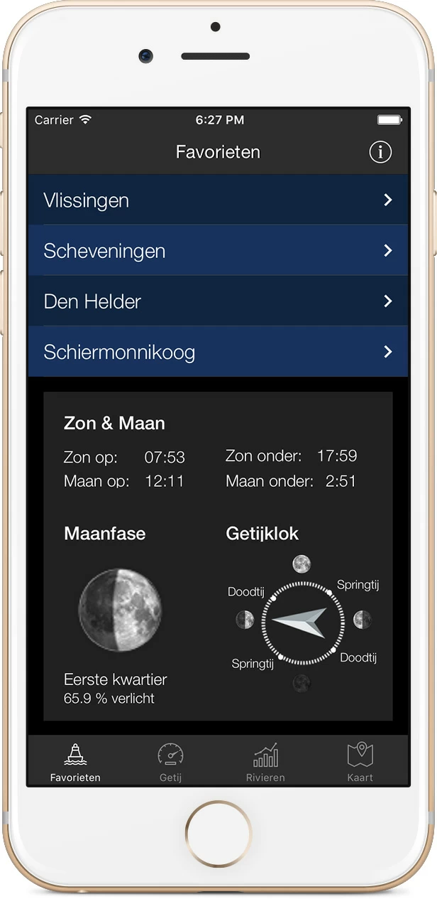
Download the app for iOS or Android.

Download The Tides for iPhone and iPad  Download The Tides for iPhone and iPad

About Water Map Live

Water Map Live is the water website and app of the Netherlands. Here you will find the most important information that you need as a nautical professional, water sports enthusiast, swimmer, water lover or weather enthusiast. Fast and complete.

Do you have good ideas or suggestions, do you want to collaborate or reuse data? Let us know, we'd love to hear from you!
 
Water Map Live for free in your website

Want to know more about Water Map Live?
Surfcheck / Waterkaart Live
Rijn en Schiekade 115 F
2311 AS Leiden (NL)
(+31) 071-2032041
Kvk: 61380431

post@waterkaart.net
 
Frequently asked questions

Download Water Map Live
 
Download Water Map Live, the app for Android   Download Water Map Live, the app for iPhone and iPad