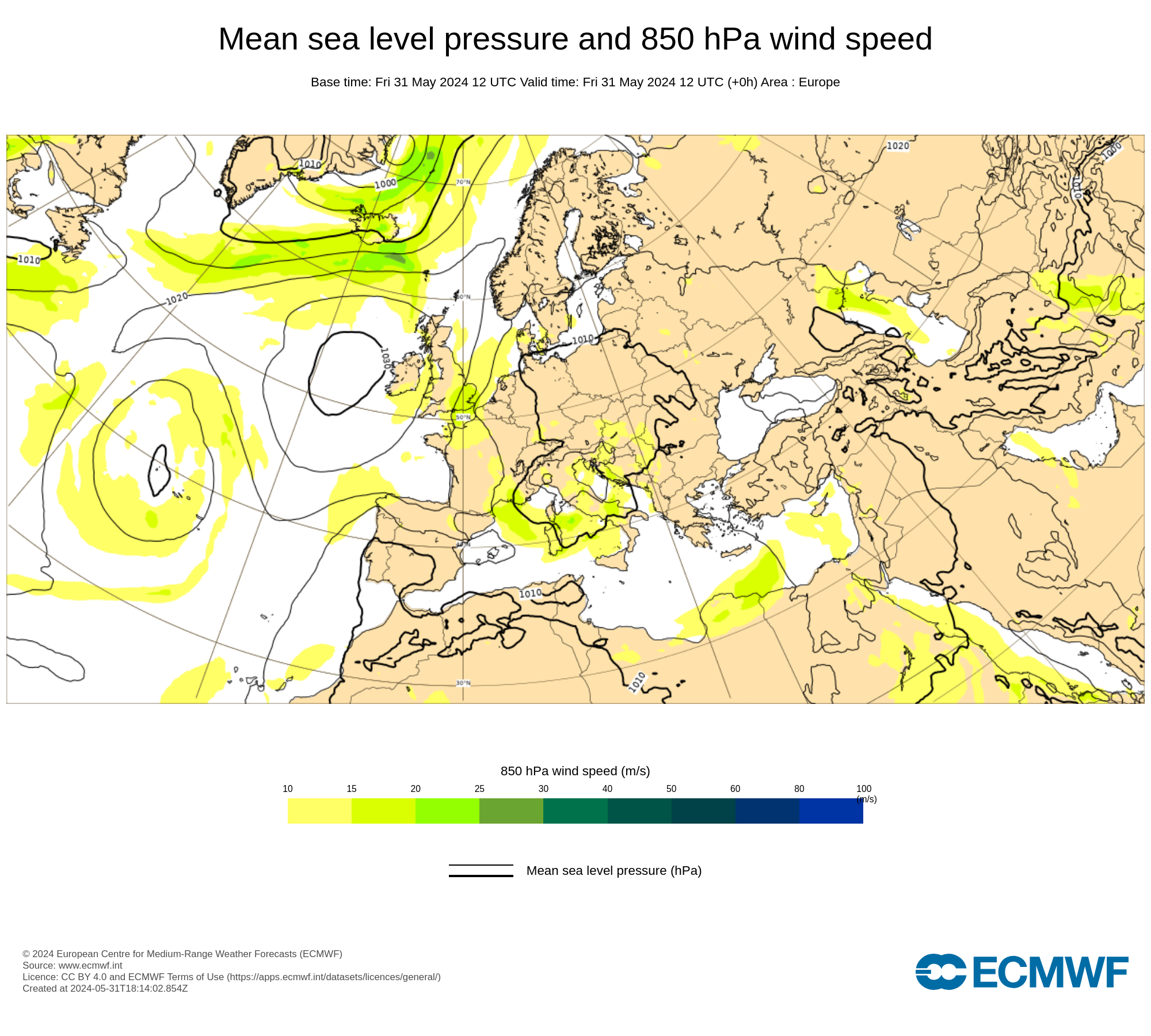
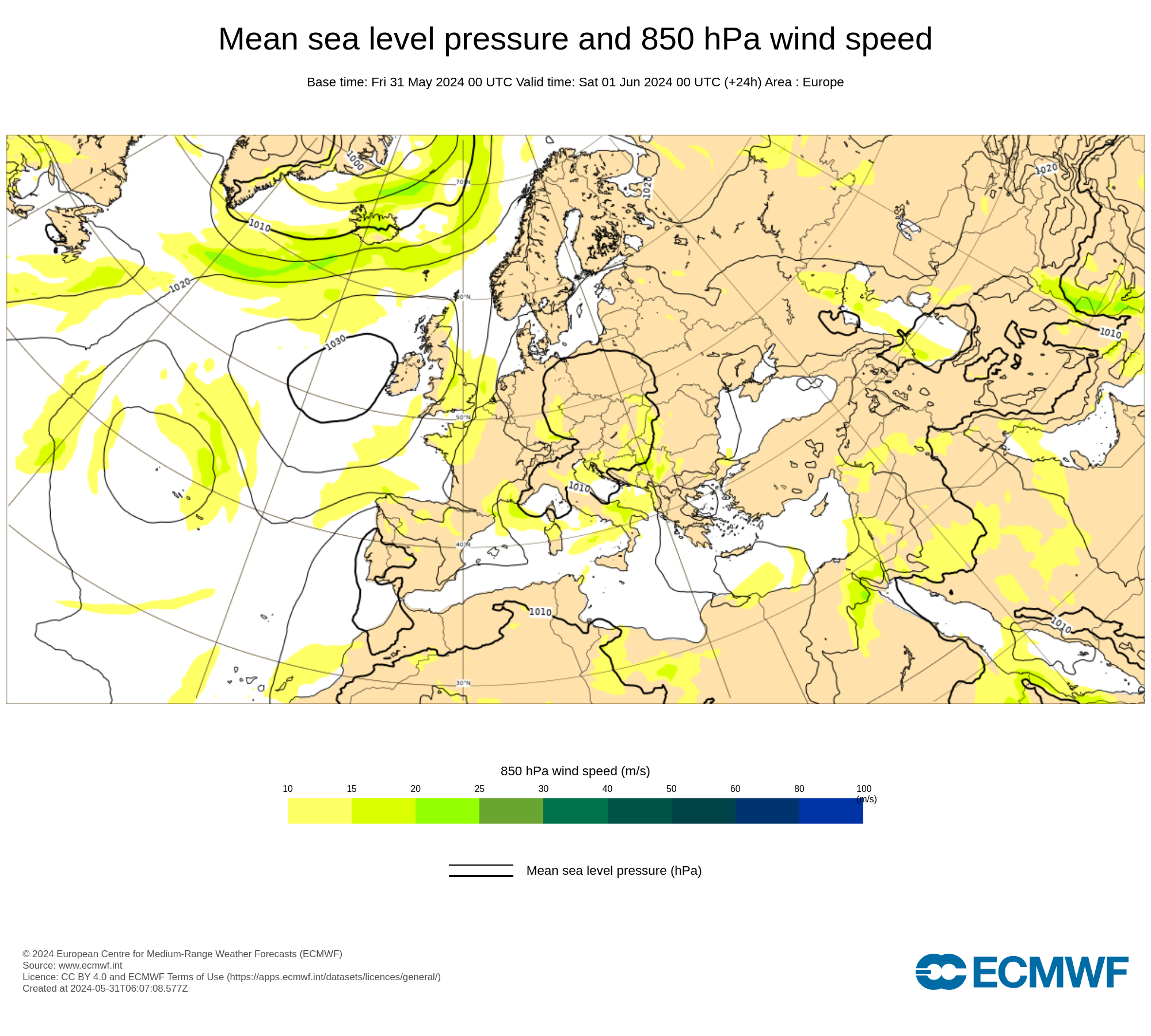
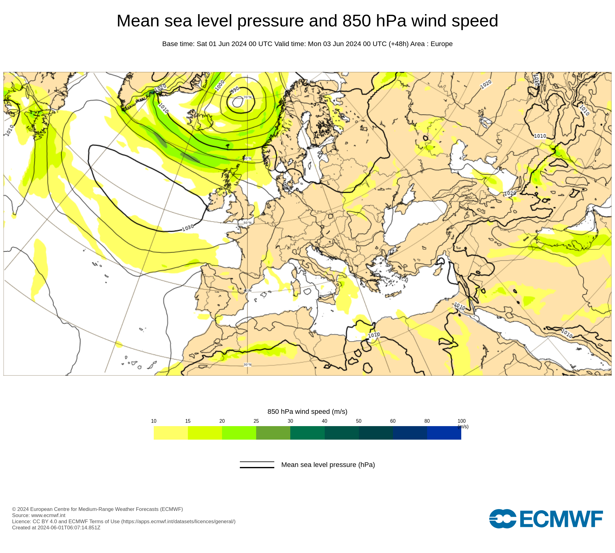
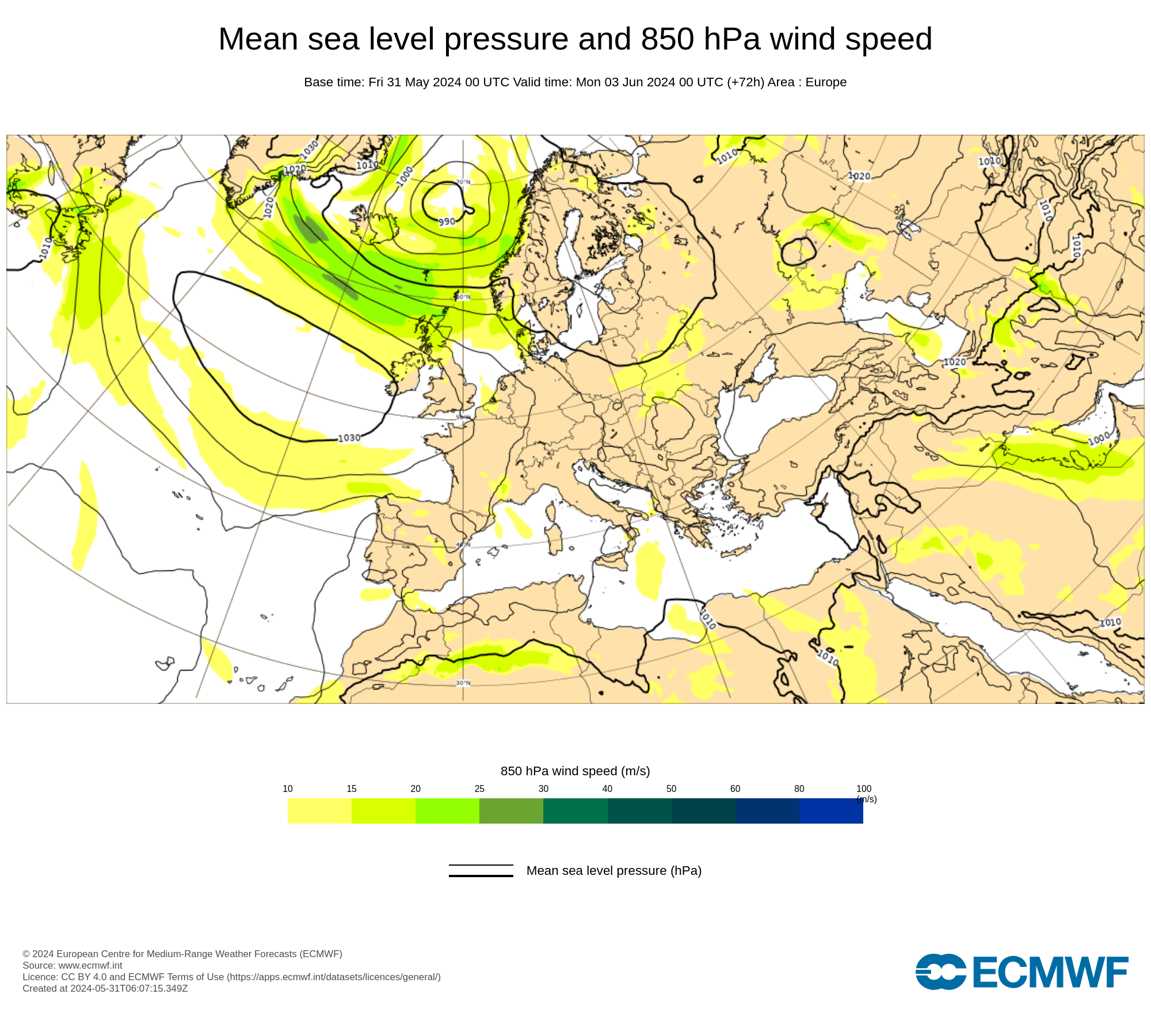
ECMWF 850 hPa model maps Western Hemisphere
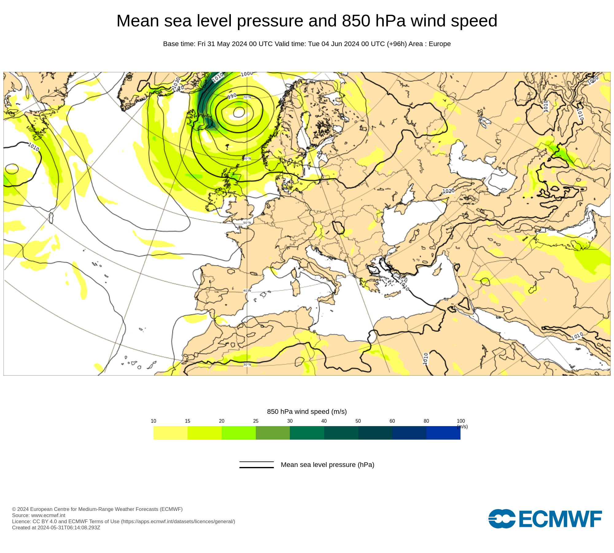
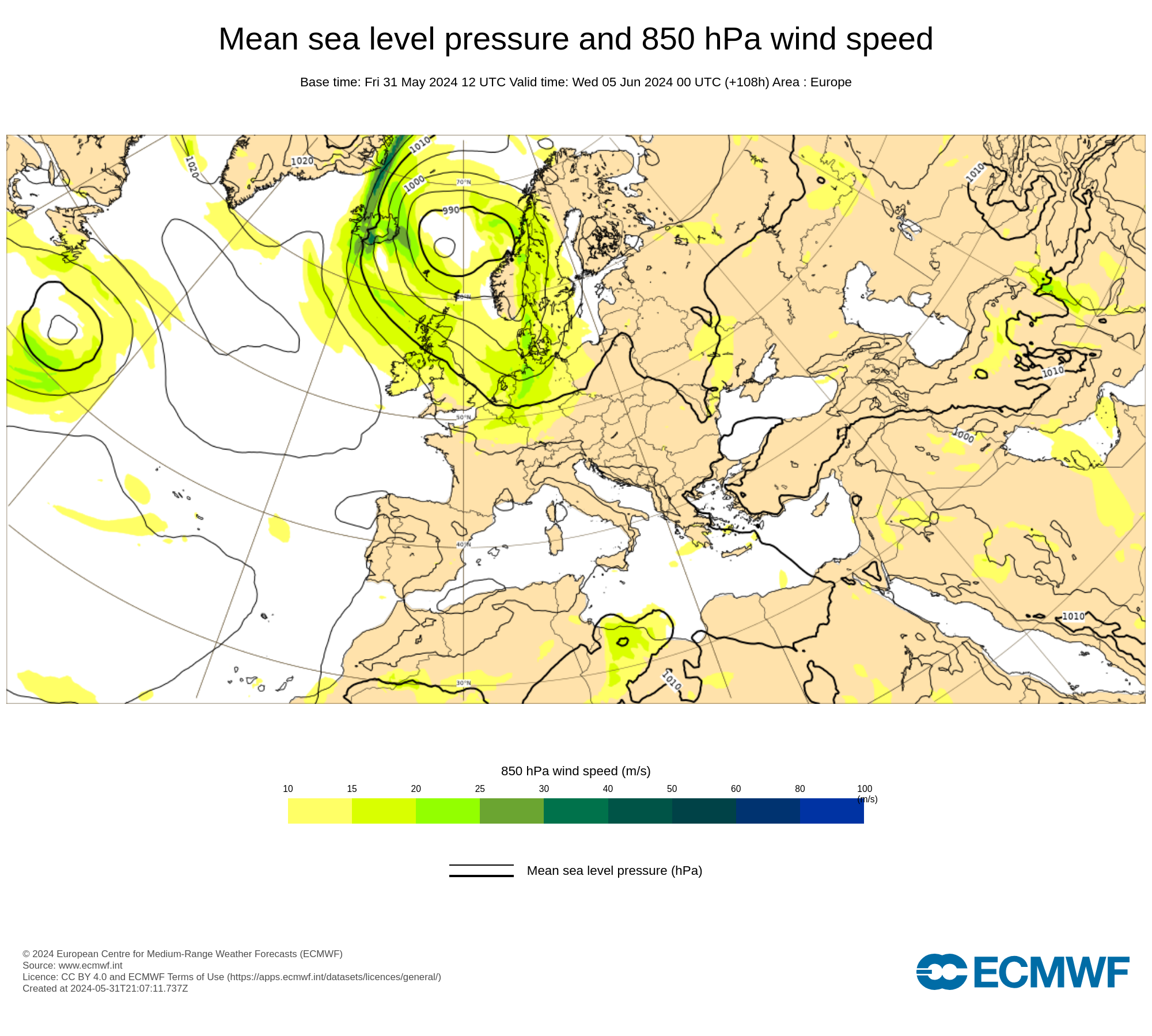
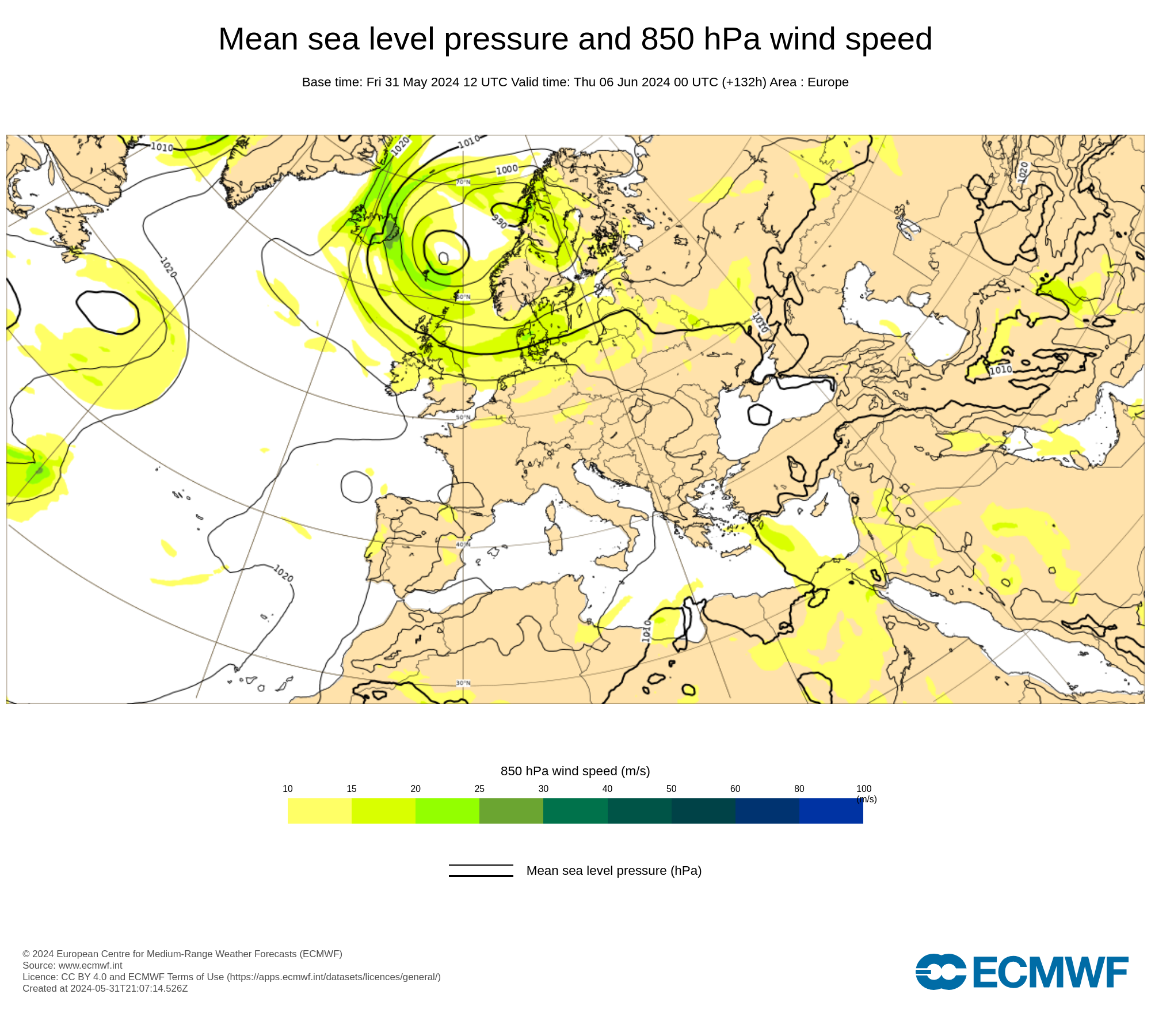
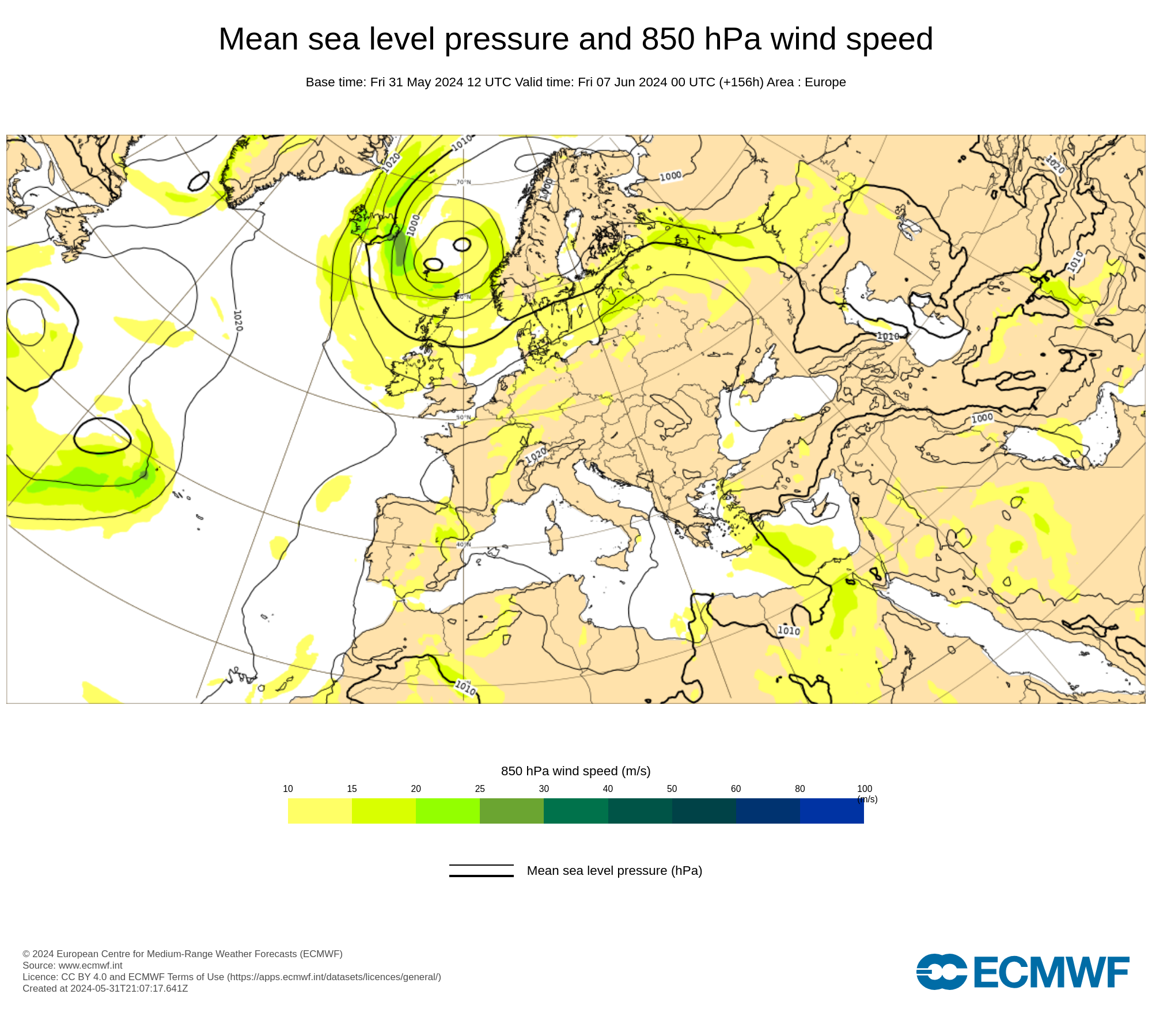
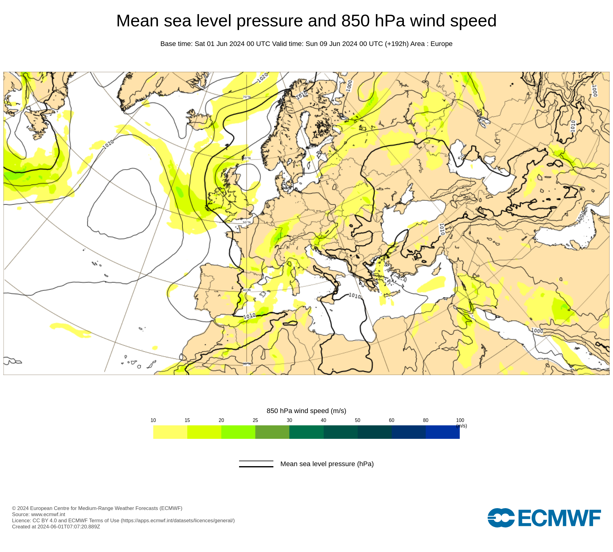
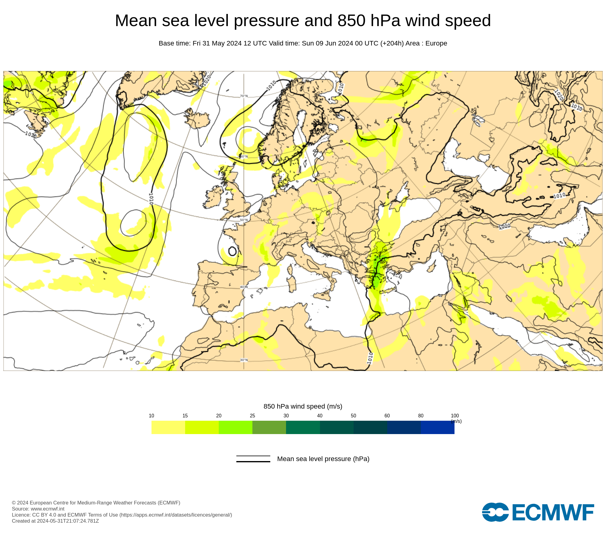
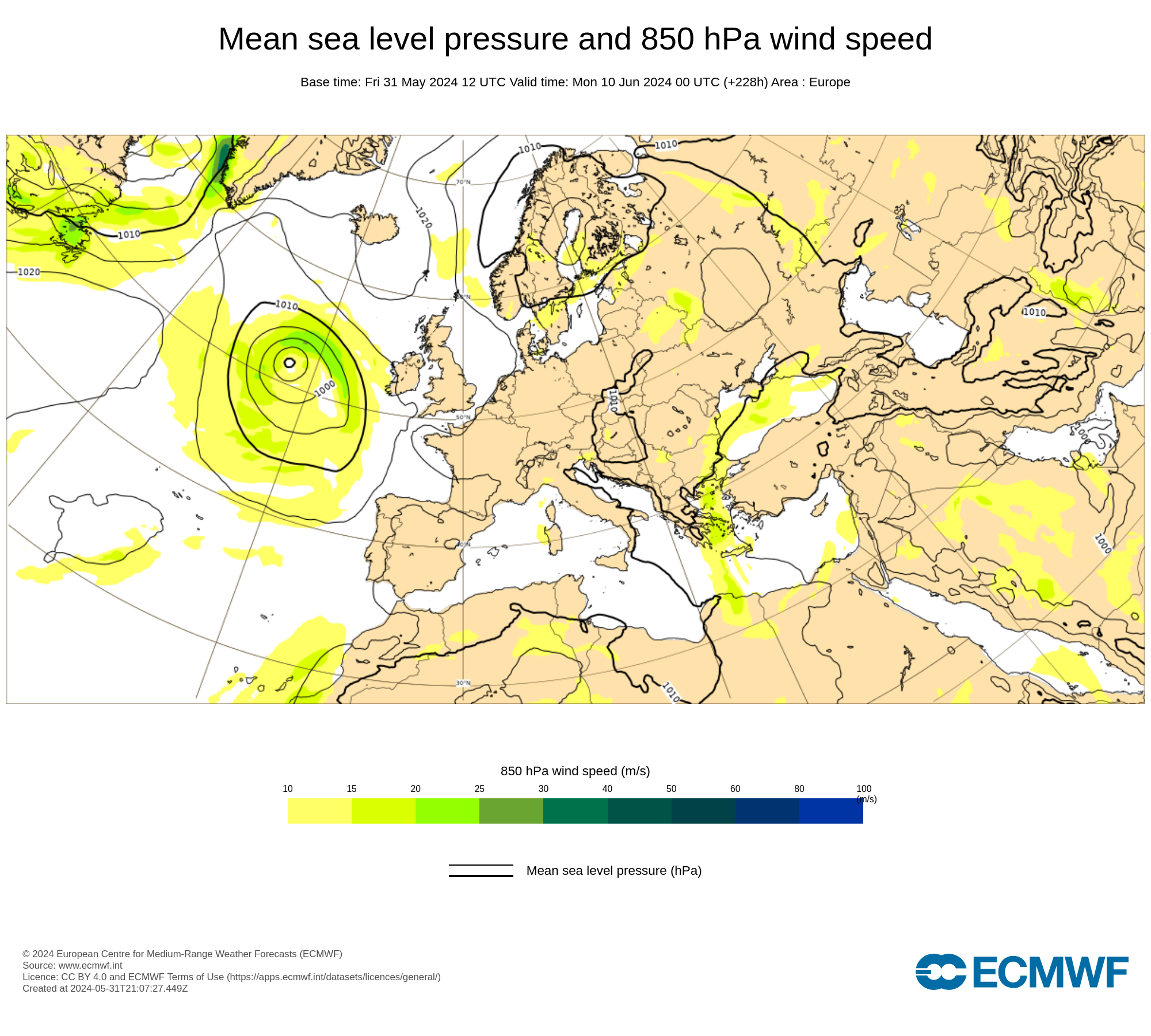
Air pressure at sea level and wind speed at the 850 hPa level. This is a meteorological standard level that is usually around 1.5 kilometers above the Earth's surface. These maps from the European Center for Medium-Range Weather Forecasts (ECMWF) show the currents of high and low pressure areas and give a good impression of weather development at macro level. The colors indicate the wind speeds in m/s. The maps are updated twice a day
Wind forecast
Netherlands
Wind forecast nodes
Beaufort wind forecast
Wind forecast + air pressure
Wadden Sea
Wind forecast nodes
Beaufort wind forecast
Wind forecast + air pressure
IJsselmeer and Frisian Lakes
Wind forecast nodes
Beaufort wind forecast
Wind forecast + air pressure
Zeeland
Wind forecast nodes
Beaufort wind forecast
Wind forecast + air pressure
Weather maps
HiRLAM analysis
DWD ICON expectation
ECMWF 850 hPa
Current satellite image
Synoptic analysis KNMI
Plumes the Netherlands