All movable bridges in Noord-Brabant

Click on the name of the bridge to get more information. You can sort the list by clicking on the words 'Bridge name' and 'City' above the table.

Bridge name and bridge page (click)  City  Photo  Map
Sint-Anthoniebrug's-hertogenboschjaWater map
Hinthamersbrug's-hertogenboschjaWater map
Industriehavenbrug's-hertogenboschWater map
Sluis V, brug over bovenhoofdAchterboschjaWater map
Wilhelminasluis, Andel, brug over bovenhoofdAndelWater map
LondenbrugAntwerpenWater map
BeeksebrugBeek en donkjaWater map
DonksebrugBeek en donkjaWater map
Oudendijkbrug, brug over buitenhoofdBerendrechtWater map
Berendrechtbrug, brug over binnenhoofdBerendrecht (b)Water map
Burgemeester Peterssluis, brug over binnenhoofdBergen op zoomjaWater map
Brug BiesthoutakkerBiestjaWater map
Brug HolenakkerBiest-houtakkerjaWater map
Sluis 18, brug over benedenhoofdBocholt (b)jaWater map
Fietsbrug over het buitenhoofd BenedensasDe heenjaWater map
PrinsenlandsebrugDinteloordWater map
SlickbrugEtten-leurWater map
AmertakbrugGeertruidenbergjaWater map
Merwedebrug, GorinchemGorinchemjaWater map
Brug GroenewoudGroenewoudjaWater map
Sluis IV, brug over benedenhoofdHaghorstWater map
Helmond, brug in de ChurchilllaanHelmondWater map
Sluis 9, brug over benedenhoofdHelmondjaWater map
Sluis 8, brug over benedenhoofdHelmondWater map
Brug HooijdonkHooidonkjaWater map
Brug HoutensHoutensjaWater map
ErpsebrugKeldonkWater map
Brug OranjelaanLaarbeekWater map
Sluis 17, brug over benedenhoofdLozen (b)Water map
Macherense BrugMacharenjaWater map
RoodevaartbrugMoerdijkjaWater map
Brug HeuvelOirschotjaWater map
Vrachelsebrug (Markbrug)OosterhoutjaWater map
Sluis I, brug over benedenhoofdOosterhoutjaWater map
Den DungensebrugPoeldonkjaWater map
VlietbrugRoosendaalWater map
Sluis 13, brug over benedenhoofdSomeren-eindjaWater map
Hefbrug SonSonjaWater map
Brug Stad van GerwenStad van gerwenjaWater map
Brug HeikantsebaanTilburgWater map
Brug EnschotsestraatTilburgjaWater map
Brug OisterwijksebaanTilburgjaWater map
Brug WaalstraatTilburgWater map
PrinsenhoevenTilburgjaWater map
Brug LijnsheikeTilburgWater map
TrappistenbrugTilburgjaWater map
Brug BosschewegTilburgjaWater map
Brug Dr. DeelenlaanTilburgWater map
Den OphefTilburgjaWater map
Waalwijk, brug over buitenhoofdWaalwijkWater map
Biesboschsluis, brug over binnenhoofdWerkendamjaWater map
brug over benedenhoofd VolkeraksluizenWillemstadWater map
ZandvlietbrugZandvliet (b)Water map
Frederik HendrikbrugZandvliet (b)Water map
Markspoorbrug ZevenbergenZevenbergen (nb)Water map


Bridges & Locks alphabet

Choose the first letter of the city or village in which you want to see the bridges:

A  B  C  D  E  F  G  H  I  J  K  L  M
N  O  P  Q  R  S  T  U  V  W  X  Y  Z


Bridges by province

Drenthe
Flevoland
Friesland
Gelderland
Groningen
Limburg
Noord-Brabant
Noord-Holland
Overijssel
Utrecht
Zeeland
Zuid-Holland


Download the app
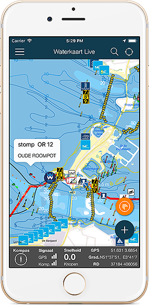
Always have the current bridge and lock times at hand? With the Water Map Live app you stay informed.

Screenshot app Water Map Live

Download the app for iOS or Android.

Download Water Map Live, app for Android  Download Water Map Live for iPhone and iPad

About Water Map Live

Water Map Live is the water website and app of the Netherlands. Here you will find the most important information that you need as a nautical professional, water sports enthusiast, swimmer, water lover or weather enthusiast. Fast and complete.

Do you have good ideas or suggestions, do you want to collaborate or reuse data? Let us know, we'd love to hear from you!
 
Water Map Live for free in your website

Want to know more about Water Map Live?
Surfcheck / Waterkaart Live
Rijn en Schiekade 115 F
2311 AS Leiden (NL)
(+31) 071-2032041
Kvk: 61380431

post@waterkaart.net
 
Frequently asked questions

Download Water Map Live
 
Download Water Map Live, the app for Android   Download Water Map Live, the app for iPhone and iPad