How does crossing a movable bridge work?
The Netherlands has more than 1500 movable bridges. What rules do you have to observe when passing, when do you have to wait, what do the lights mean and how do you ensure that the bridge keeper notices you?
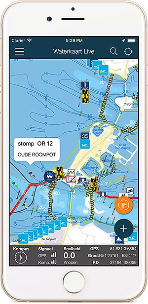
All about the Rottumerbrug, location, opening hours and contact details. On the water map below do you see the bridge in its immediate vicinity. On the right on this page you will find the operating times of this bridge, if available the maritime radio data and telephone numbers, and any additional instructions.
Open the Water Map for Heerenveen in full window

The Netherlands has more than 1500 movable bridges. What rules do you have to observe when passing, when do you have to wait, what do the lights mean and how do you ensure that the bridge keeper notices you?
Op Waterkaart.net en in de Stroomatlas apps vind je nu geheel vernieuwde stroomdata, inclusief animatie en hoge resolutiedata. De hydrografische dienst van de Koninklijke Marine publiceert al decennialang in de bekende HP33 stroomatlas de stroomkaarten van de Noordzee, de …
De Staande Mast Route via zowel Amsterdam als Haarlem is heel 2026 en zeker een deel van 2027 voor schepen hoger dan 6.8 meter gestremd. Door Amsterdam is de maximale doorvaarthoogte zelfs maar 2 meter. Iets om rekening mee te houden als je een vaarroute plant. Het gaat …
We hebben Waterkaart Live zo logisch en helder als mogelijk opgezet, toch kan het altijd zijn dat je vragen hebt bij een bepaalde optie, of hoe de app werkt. We hebben de meestgestelde vragen in dit artikel opgenomen, misschien staat die van jou er ook bij! Deutsche Version …
| Vertical clearance when closed 0.8 meter | Width 7 meter |
| VHF-Channel 18 | Phone number unknown |
From 20-03 until 31-05
All days: between 09:00 and 19:00From 01-06 until 31-08
All days: between 09:00 and 20:00From 01-09 until 31-10
All days: between 09:00 and 19:00From 01-11 until 19-03
Mon to Sat: 9-17 hrs: On request. Calling at 058-29 25 888. Option 4 (accessible from 08:30 to 16:00) 2 hours in advance a call must be requested.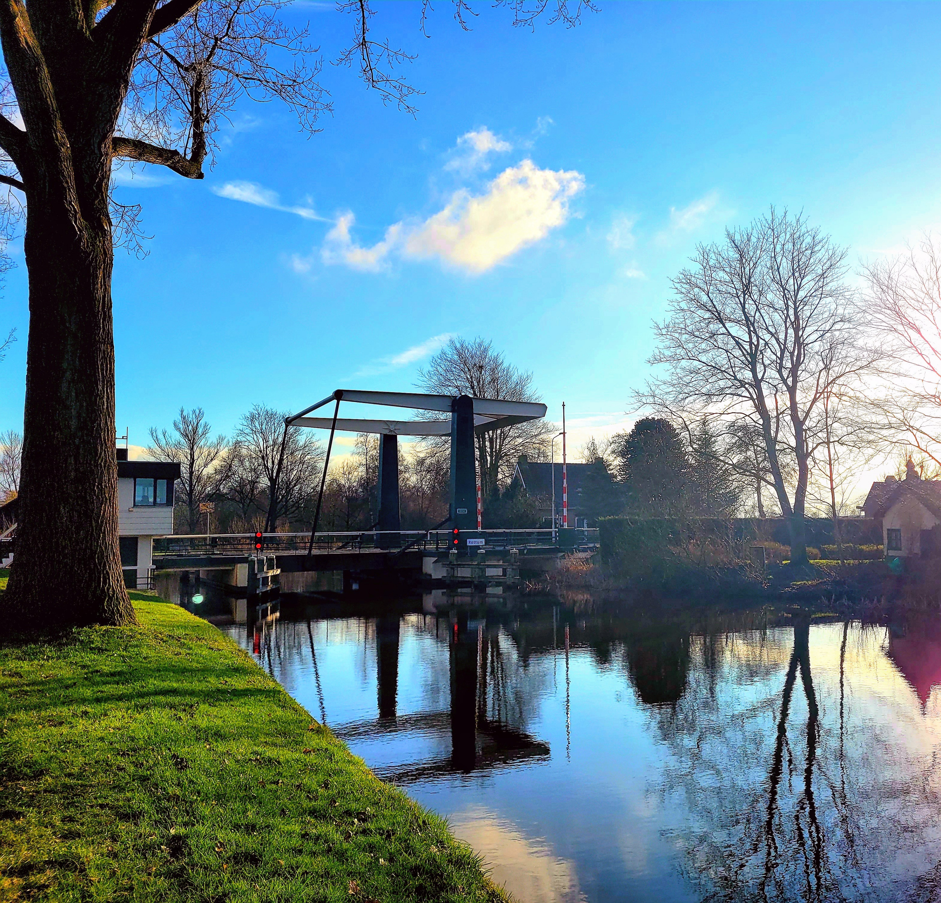
Administrator visiting address
Tweebaksmarkt 52 Leeuwarden
Phone number: 058-2925925
Data updated: 28 Juli 2026, 13:02 uur
Klopt er iets niet? Meld het de Vaarmelder.