
How does crossing a movable bridge work?
The Netherlands has more than 1500 movable bridges. What rules do you have to observe when passing, when do you have to wait, what do the lights mean and how do you ensure that the bridge keeper notices you?
All about the Brug Ouderkerk (in de N522), location, opening hours and contact details. On the water map below do you see the bridge in its immediate vicinity. On the right on this page you will find the operating times of this bridge, if available the maritime radio data and telephone numbers, and any additional instructions.
Open the Water Map for Ouderkerk aan de Amstel in full window
The Netherlands has more than 1500 movable bridges. What rules do you have to observe when passing, when do you have to wait, what do the lights mean and how do you ensure that the bridge keeper notices you?
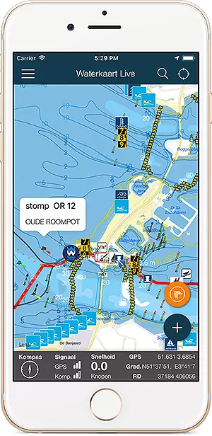
Waterkaart Live is voorzien van een prachtige nieuwe basiskaart met enorm veel waterdiepteinformatie. Dit is hoe je deze gegevens op de verschillende wateren interpreteert. De gegevens in de getijdengebieden komen voor het grootste deel uit de IENC's ( Inland Electronic …
Via de Waterkaart Live apps kun je natuurlijk je locatie op de kaart bekijken en volgen. Dat kan nu ook met met waterkaart.net, óók met externe GPS-ontvangers. De nieuwe GPS-trackingfunctie vind je rechtsboven in het kaartvenster. Om deze functie te kunnen gebruiken is een …
Je kunt in Waterkaart Live heel gemakkelijk routes via GPX bestanden importeren en op de kaart zetten. Hoe je dat doet en waar je vaarroutes vindt lees je hier. GPX-bestanden bevatten routes of tracks. Dat kunnen vooraf geplande routes zijn, of routes die je hebt opgenomen. …
Brug Ouderkerk (in de N522)
Vertical clearance when closed: 2.69 meter, width: 10.5 meter.
Number of passable openings: 3, the highest passage opening is number: 2 (movable part) vertical clearance 2.7 m , width: 10.5 m
Note: vertical clearance compared to Channel level (-0.4 with respect to NAP), take possible water level changes into account.
Comment bridge management (NL): Contact via VHF CH20 of knop op remmingwerk
VHF-Channel: Channel 20, radio traffic Two waySaturday, between 06:00h and 22:00h
Sundays and public holidays, between 08:00h and 22:00h
Working days, between 05:30h and 06:30h
Working days, between 06:30h and 08:30h (Bedienpauze van minimaal 30 minuten tussen brugsluiting en volgende brugopening)
Working days, between 08:30h and 15:30h
Working days, between 15:30h and 18:00h (Bedienpauze van minimaal 30 minuten tussen brugsluiting en volgende brugopening)
Working days, between 18:00h and 22:00h
Operating times all year round
From 01-01 until 31-03
Saturday, between 06:00h and 18:00h
Sundays and public holidays, between 00:00h and 23:59h - No service
Working days, between 05:30h and 06:30h
Working days, between 06:30h and 08:30h (Bedienpauze van minimaal 30 minuten tussen brugsluiting en volgende brugopening)
Working days, between 08:30h and 15:30h
Working days, between 15:30h and 18:00h (Bedienpauze van minimaal 30 minuten tussen brugsluiting en volgende brugopening)
Working days, between 18:00h and 22:00h
From 01-04 until 04-05
Saturday, between 06:00h and 21:00h
Sundays and public holidays, between 08:00h and 21:00h
Working days, between 05:30h and 06:30h
Working days, between 06:30h and 08:30h (Bedienpauze van minimaal 30 minuten tussen brugsluiting en volgende brugopening)
Working days, between 08:30h and 15:30h
Working days, between 15:30h and 18:00h (Bedienpauze van minimaal 30 minuten tussen brugsluiting en volgende brugopening)
Working days, between 18:00h and 22:00h
From 05-05 until 28-05
Holidays, monday, Tuesday, Wednesday, Thursday, Friday, between 05:30h and 06:30h
Holidays, monday, Tuesday, Wednesday, Thursday, Friday, between 06:30h and 08:30h (Bedienpauze van minimaal 30 minuten tussen brugsluiting en volgende brugopening)
Holidays, monday, Tuesday, Wednesday, Thursday, Friday, between 08:30h and 15:30h
Holidays, monday, Tuesday, Wednesday, Thursday, Friday, between 15:30h and 18:00h (Bedienpauze van minimaal 30 minuten tussen brugsluiting en volgende brugopening)
Holidays, monday, Tuesday, Wednesday, Thursday, Friday, between 18:00h and 22:00h
Saturday, between 06:00h and 21:00h
Sunday, between 08:00h and 21:00h
From 29-05 until 31-05
Saturday, between 06:00h and 21:00h
Sundays and public holidays, between 08:00h and 21:00h
Working days, between 05:30h and 06:30h
Working days, between 06:30h and 08:30h (Bedienpauze van minimaal 30 minuten tussen brugsluiting en volgende brugopening)
Working days, between 08:30h and 15:30h
Working days, between 15:30h and 18:00h (Bedienpauze van minimaal 30 minuten tussen brugsluiting en volgende brugopening)
Working days, between 18:00h and 22:00h
From 01-06 until 15-09
Saturday, between 06:00h and 22:00h
Sundays and public holidays, between 08:00h and 22:00h
Working days, between 05:30h and 06:30h
Working days, between 06:30h and 08:30h (Bedienpauze van minimaal 30 minuten tussen brugsluiting en volgende brugopening)
Working days, between 08:30h and 15:30h
Working days, between 15:30h and 18:00h (Bedienpauze van minimaal 30 minuten tussen brugsluiting en volgende brugopening)
Working days, between 18:00h and 22:00h
From 16-09 until 31-10
Saturday, between 06:00h and 21:00h
Sunday, between 08:00h and 21:00h
Working days, between 05:30h and 06:30h
Working days, between 06:30h and 08:30h (Bedienpauze van minimaal 30 minuten tussen brugsluiting en volgende brugopening)
Working days, between 08:30h and 15:30h
Working days, between 15:30h and 18:00h (Bedienpauze van minimaal 30 minuten tussen brugsluiting en volgende brugopening)
Working days, between 18:00h and 22:00h
From 01-11 until 23-12
Saturday, between 06:00h and 18:00h
Sundays and public holidays, between 00:00h and 23:59h - No service
Working days, between 05:30h and 06:30h
Working days, between 06:30h and 08:30h (Bedienpauze van minimaal 30 minuten tussen brugsluiting en volgende brugopening)
Working days, between 08:30h and 15:30h
Working days, between 15:30h and 18:00h (Bedienpauze van minimaal 30 minuten tussen brugsluiting en volgende brugopening)
Working days, between 18:00h and 22:00h
On 24-12
All days, between 05:30h and 06:30h
All days, between 06:30h and 08:30h (Bedienpauze van minimaal 30 minuten tussen brugsluiting en volgende brugopening
)
All days, between 08:30h and 15:30h
All days, between 15:30h and 16:00h (Bedienpauze van minimaal 30 minuten tussen brugsluiting en volgende brugopening
)
From 25-12 until 30-12
Saturday, between 06:00h and 18:00h
Sundays and public holidays, between 00:00h and 23:59h - No service
Working days, between 05:30h and 06:30h
Working days, between 06:30h and 08:30h (Bedienpauze van minimaal 30 minuten tussen brugsluiting en volgende brugopening)
Working days, between 08:30h and 15:30h
Working days, between 15:30h and 18:00h (Bedienpauze van minimaal 30 minuten tussen brugsluiting en volgende brugopening)
Working days, between 18:00h and 22:00h
On 31-12
All days, between 05:30h and 06:30h
All days, between 06:30h and 08:30h (Bedienpauze van minimaal 30 minuten tussen brugsluiting en volgende brugopening
)
All days, between 08:30h and 15:30h
All days, between 15:30h and 16:00h (Bedienpauze van minimaal 30 minuten tussen brugsluiting en volgende brugopening
)
Administrator
Provincie Noord-Holland
Postbus 123
2000 MD Haarlem
Administrator visiting address
Dreef 3 Haarlem
Phone: 023-5143143
Data updated: 18 Juli 2025, 14:20 uur, all data comes directly from Rijkswaterstaat systems.


-OuderkerkaandeAmstel.jpg)