This is how the route planner works
If you use the Water Map Live app, you can plan and save sailing routes yourself. The route takes into account the height of bridges (and locks) on your route. Using the route planner is simple, on this page we explain how it works.
Dutch Version 🇳🇱 | German version 🇩🇪
The sailing route planner in Water Map Live works exactly like a route planner in the car: enter a starting point and an end point and the app will calculate the fastest route between these two points. Of course, 'fast' is not always the most important thing, especially if you are a recreational water user. In that case, you can also select multiple waypoints to plan your own beautiful tourist route.
Planning a route is easy
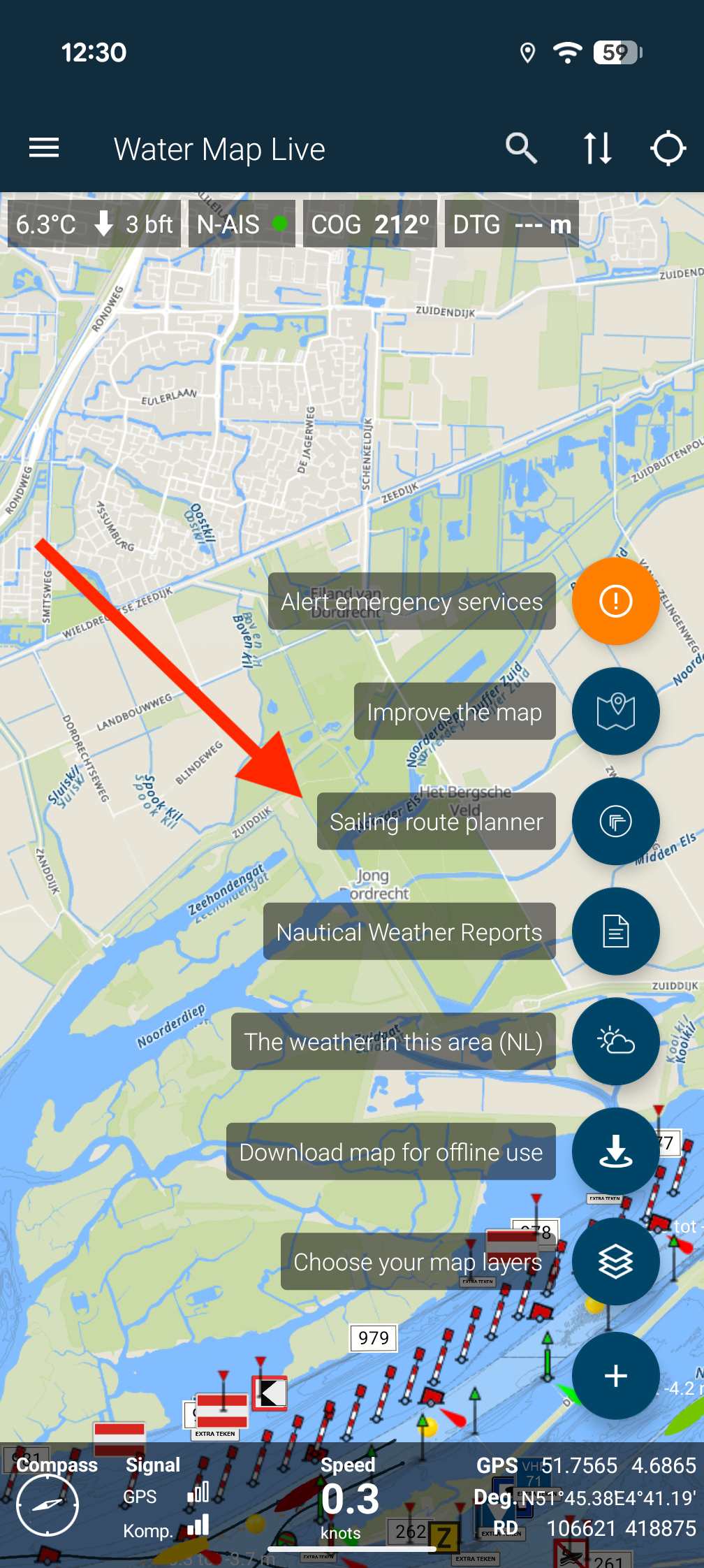
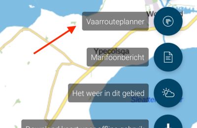
You start the route planner from the Water Map Live app. On the main screen you will see a round button at the bottom right, press it and a menu with many useful functions will appear, click on the 'Sailing Route Planner' function to start it (see the red arrow in the image below.)
Haven't you installed the Water Map Live app yet? Then you can download it for free from the App Store or Play store on your device, see also watermaplive.net/app - you can try out the app completely for free for four days, including the route planner. If you want to continue using the app afterwards, you can top it up for only €9.99 per year.
Step 2: draft and creep height
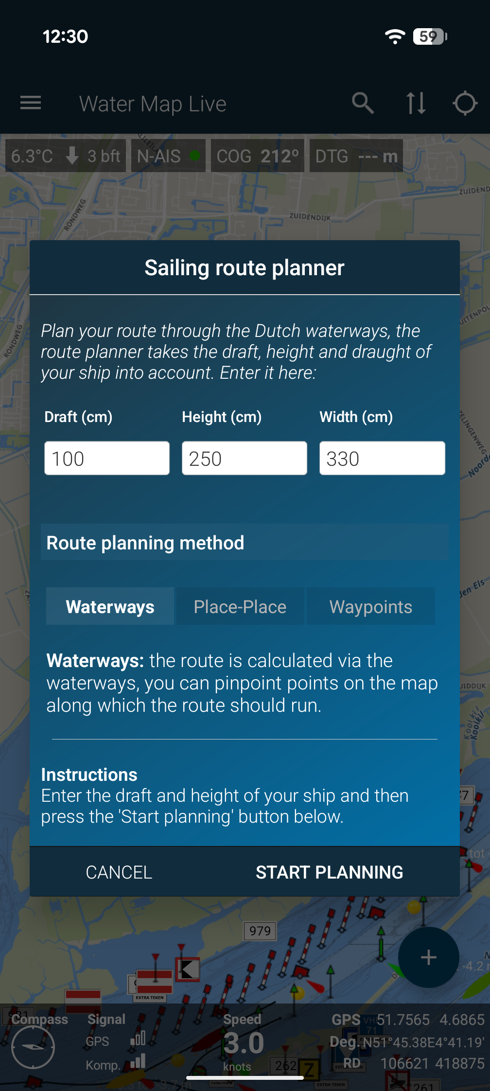
The route planner takes into account the height of bridges on your route and the depth of the waterway. To do this, you must enter the draft and height of your ship in the window you now see. If you have previously created an account or are logged in (see below), these details have already been filled in for you. Handy!
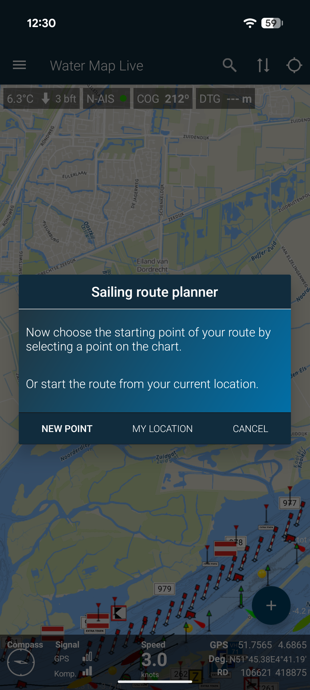
After entering, click on the 'Start route plans' button. You can then mark a starting point and end point on the map. The app guides you through the process step by step. It's very simple. It is important that you take the time to read the instructions on the screen.
A quick tip: you can pin a point on the map with a so-called 'long press' - that's smartphone language for pressing on your screen for half a second. So pin your start or end point by briefly pressing your finger on the screen, then you will see a marking of the point.
Step 3: start waypoints or calculation
After you have planned the second point, you can choose: do you want to plan more waypoints to complete a route via a specific waterway? Or do you just want to see the route between the two points you marked on the map? In the window you now see, choose the corresponding options via the buttons at the bottom: New point or Plan route.
You can also see an approximation of the calculation time needed to put the route on the screen.
You can mark up to twelve waypoints on the map, so keep that in mind.
Step 4. The route is planned!
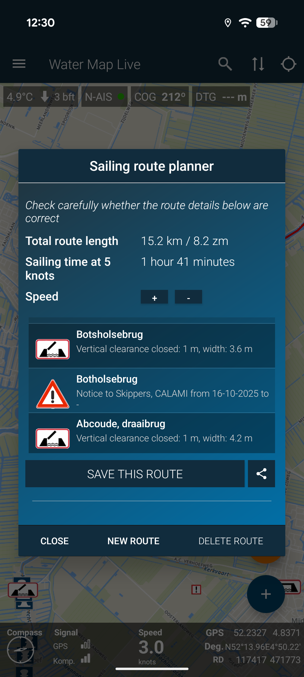
If you selected the 'Plan Route' option in the previous window, the app will calculate the route for your ship. Make sure that your device currently has an internet connection: the calculation is done by the watermaplive.net server. Once the route has been calculated, it is saved on your device and you can always view it later without internet. The route remains visible on the Water Map until you delete it yourself.
On this screen you will also see the Save this route button - with this function you can save the route in your Water Map Live account. If you are already logged in, this will happen all at once. If you are not logged in or you do not have an account, click on the orange message that the app gives you to create this account or log in. An account is of course free and serves to store your boat details and routes to store and share with other devices, and with this website watermaplive.net. This is very useful, for example, you can plan routes at home in peace and quiet and save them so you can retrieve them on the water with one click. Give it a try.
Want to know more about your account? Click on the button with the double vertical arrows at the top right.
PLEASE NOTE: This route is a suggestion and always runs via official waterways established by Rijkswaterstaat. That is also why the route never starts and ends exactly at the points you choose: the route planner searches for the nearest navigable waterway (guaranteed by RWS).
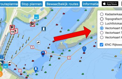
Yet the water is a constantly changing environment, so always check the route yourself when you go sailing. Does everything make sense? Are the bridges, locks and draft of the waterways correct? Is there any work on the route? (turn on the current Shipping Reports as a map layer, see also the round button in the app). You also have to plan your own route in city water.
The sailing time
This is an indication and is calculated with an average sailing speed of 5 knots, more than 9 km/h, you can vary yourself with the + and - buttons to adjust the estimate for your own pace. We charge an additional 30 minutes of waiting and locking time for each lock on the route. No waiting time is taken into account for bridges.
Download the map
It is highly recommended to download the map of your route before sailing. Then it will always appear smoothly on the screen along the way. Select the option 'Download map for offline use', also via the blue round button at the bottom right of the screen.
If you have any questions or suggestions about this feature, please let us know via post@watermaplive.net.
Have fun with your boat trip!