
How does crossing a movable bridge work?
The Netherlands has more than 1500 movable bridges. What rules do you have to observe when passing, when do you have to wait, what do the lights mean and how do you ensure that the bridge keeper notices you?
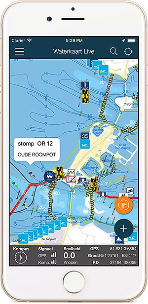
All about the Wolsumerketting, brug, location, opening hours and contact details. On the water map below do you see the bridge in its immediate vicinity. On the right on this page you will find the operating times of this bridge, if available the maritime radio data and telephone numbers, and any additional instructions.
Open the Water Map for Wolsumerketting in full window
The Netherlands has more than 1500 movable bridges. What rules do you have to observe when passing, when do you have to wait, what do the lights mean and how do you ensure that the bridge keeper notices you?
Als je de Waterkaart Live app gebruikt, kun je zelf vaarroutes plannen en opslaan. Daarbij houdt de route rekening met de hoogte van bruggen (en sluizen) op je route. Het gebruik van de routeplanner is eenvoudig, op deze pagina leggen we uit hoe het werkt. Deutsche Version …
Waterkaart.net is nu uitgebreid met de Inland ENC navigatiekaarten van Rijkswaterstaat. Ze bevatten zeer veel details over het water. Je kunt deze heel makkelijk als een extra kaartlaag aanzetten. Zo werkt dat. Deutsche Version 🇩🇪 | English version 🇬🇧 IENC …
Goed nieuws voor wie door Noord-Holland vaart: vanaf nu kun je via Waterkaart Live automatisch brugopeningsverzoeken laten sturen. Zo wordt varen een stuk makkelijker en hoef je minder te wachten. Je hoeft alleen de Netwerk-AIS functie aan te schakelen. Zo werkt dat. …
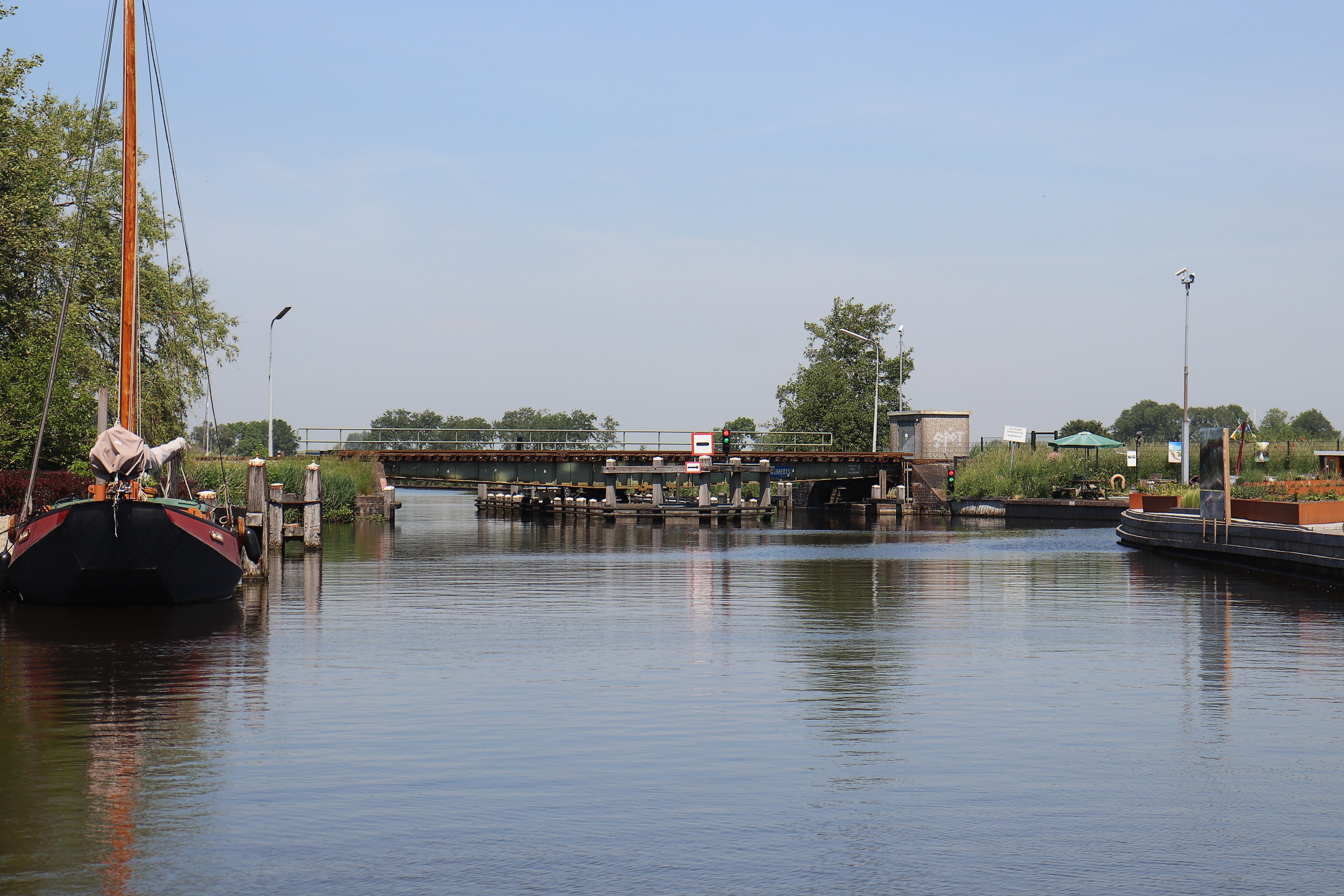
Wolsumerketting,-brug
Vertical clearance when closed: 1 meter, width: 7.05 meter.
Number of openings: 1
Note: vertical clearance compared to Channel level, take possible water level changes into account. take local water levels into account. There is one target level for the Frisian reservoir - the connected system of canals and lakes in Friesland - which is 52 centimeters below NAP.
Comment bridge management (NL): NS brugnr. 43 / Seingeving groep B. Wijdte tussen remmingwerken. Bediening op afstand vanaf brug Nijezijl.
VHF-Channel: channel not specifiedAll days, between 09:00h and 20:00h - On demand only
Operating times all year round
On 31-03 (Eerste Paasdag)
Weekdays and Saturdays, between 09:00h and 17:00h - On demand only
From 01-04 until 31-10
All days, between 09:00h and 20:00h - On demand only
From 01-11 until 30-03
Holidays, monday, Tuesday, Wednesday, Thursday, Friday, Saturday, between 09:00h and 17:00h
Administrator
ProRail
Postbus 2038
3500 GA Utrecht
Administrator visiting address
Moreelsepark 3 Utrecht
Phone: 088-2317104
Data updated: 29 April 2024, 14:55 uur, all data comes directly from Rijkswaterstaat systems.

